
Empfohlen
Weitere ähnliche Inhalte
Was ist angesagt?
Was ist angesagt? (20)
Andere mochten auch
Andere mochten auch (20)
Ähnlich wie CHANDIGARH - the city beautiful
Ähnlich wie CHANDIGARH - the city beautiful (20)
Kürzlich hochgeladen
Kürzlich hochgeladen (20)
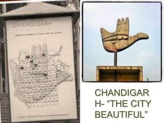
CHANDIGARH - the city beautiful
- 2. GENERAL INTRODUCTION TO CHANDIGARH CHANDIGARH is a City and a UNION TERRITORY in the Northern part of India that serves as the capital of the states of PUNJAB and HARYANA. CHANDIGARH, the Dream city of India’s first PM, Pt.Jawaharlal Nehru was planned by the legendary architect LE CORBUSIER.
- 3. GEORAPHICAL LOCATION & LINKAGES SHIVALIK HILL RANGES SUKHNA CHOE PATIALA- KI-RAO It is located on the border of Punjab & Haryana.
- 4. Area 114 sq kms Longitude 760 47' 14E Latitude 300 44' 14N Altitude 304-365 meters above MSL with 1% drainage gradient Annual Rainfall (average) 1110.7 mm Monsoon July-September Prevalent Winds From the North West to South East in Winter and reverse in Summer Original survey plan of the proposed Chandigarh. CLIMATE AND DEMOGRAPHY Chandigarh was planned for a population of half-a- million. Demographic data indicate that between 1961 and 1971, the population increased by 144.59%,one of the highest for urban areas in India. According to 1981 census, it grew by another 75.55 percent, followed by 42.16 percent in 1991 and by 40.33 per cent in 2001 (with a total population of 9,00,635).
- 5. HISTORY INDIA DURING PARTITION •After the loss of Lahore, the idea of building a new capital for the Indian part of Punjab took form in 1948. •Pandit Jawaharlal Nehru said “Let this be a new town, symbolic of freedom of India unfettered by the traditions of the past….. an expression of the nation’s faith in the future”. The city is a product of Nehru’s vision. A need for the capital Rehabilitating refugees A centre for governance A rich cultural legacy like Lahore A vision of the future
- 6. SITE SELECTION • The present site was selected in 1948 taking into account various attributes such as Central location in the state proximity to the national capital availability of sufficient water supply fertile of soil gradient of land for natural drainage beautiful site with the panorama of blue hills as backdrop moderate climate. The site was the sub mountainous area of the Ambala district about 150 miles north of New Delhi. The area was a flat, gentle sloping plain of agriculture land consisting of 59 villages. SITE SELECTION
- 7. B D C C E A F PLANNER: ALBERT MAYER: THE MASTER PLAN BY: MATHEW NOWICKI A- APARTMENT HOUSING B-LOW RISE HOUSING C-SCHOOLS D-TEMPLE E –OUTDOOR THEATRE F -BAZAR • Fan shaped master plan • Spreads gently to fill the site between the two river beds • A curving network of main roads surrounds the residential blocks • 2 axial routes bordered by linear parks connected the zones. • The overall pattern avoids the geometric grid in favor of a loosely curving system
- 8. Novicki was tragically killed in an air accident and Mayer decided to discontinue. Thereafter, the work was assigned to a team of architects led by Charles Eduard Jeanneret better known as Le Corbusier in 1951. He was assisted by three senior architects, Maxwell Fry, his wife Jane B Drew and Corbusier’s cousin, Pierre Jeanneret. Le Corbusier Pierre Jeanneret Maxwell Fry Jane B. Drew
- 9. LE CORBUSIER CONCEPT • BASIC PLANNING CONCEPTS • The city plan was conceived as post war ‘garden city’ wherein vertical and high rise buildings were ruled out, keeping in view the living habits of the people. • Le modular system • Analogous to human body – HEAD : capital (place of power) – HEART : the city centre – STOMACH :the commercial area – ARMS :university and industrial zone – LUNGS : leisure valley, open spaces – ARTERIES : network of roads
- 10. The Master plan prepared by Le Corbusier was broadly similar to the one prepared by the team of planners led by Albert Mayer and Mathew Nowicki except that the shape of the city plan was modified from one with a curving road network to rectangular shape with a grid iron pattern for the fast traffic roads, besides reducing its area for reason of economy.
- 11. LE CORBUSIER PLANNING STRATEGIES • Planned with focus on urban design , architectural aesthetics , preservation of natural environment , conservation of buildings and open spaces , hierarchical road network • Divided the human functions into circulation , living , working , care body and spirit with strict zoning • City planning was against the traditional indian cities • Replaced the native indian town plan into superblocks
- 12. SITE PLAN
- 13. CIRCULATION •An integrated system of seven road types V1 : fast roads connecting chandigarh to other towns V2 : arterial roads V3 :fast vehicular roads V4 : MEANDERING SHOPPING STREETS V5 :SECTOR CIRCULATION ROADS V6 : ACCESS ROADS TO HOUSES V7 : FOOTPATHS AND CYCLE TRACKS ` corbusiers conceptual sketch showing the v-road system BUSES WILL PLY ONLY ON V1, V2, V3 AND V4 ROADS •Pathways for cyclists •Roads intersected at right angles forming a grid •Hierarchy of movement •Residential areas segregated from the traffic
- 15. LIVING • 'The functions of living occupies primary place. • Le corbusier planned that every dwelling should have three elements of sun, space and greenery. • The housing in the city can be sub-divided into two parts- – Government housing – private housing. GOVERNMENT HOUSING PRIVATE HOUSE-CONTROLLED DEVELOPMENT
- 16. THE SECTOR • The primary module of the city ‘s design is a sector , neighborhood unit of size 800mtrs×1200mtrs • Each sector is a self sufficient unit having shops ,school , health centers and places of recreations and worship • The population of a sector varies between 3000and 2000 depending upon the sizes of plots and the topography of the area • Convenient walking distance for social services like schools and shopping centers
- 17. •• The basic planning of the city is a sector • to accommodate 3,000 to 25,000 persons • 30 sectors in chandigarh • 24 are residential • The sectors surrounded by high speed roads • Bus stops every 400m • The main principle of the sector is that never a door will open on the surrounding of fast vehicular road • The size of the sector is based on the concept of no pedestrian need to walk for more than 10min.
- 18. PRINCIPLES OF URBAN DESIGN • Convenient walking distance for special services like schools and shopping centers. • Street system • Major roads should not pass through residential neighborhood. • Internal road pattern should encourage quite , safe, low volume traffic movement. • Facilities • Orderly arrangement of facilities which would be shared common by the residents • A unit having shops , school , health centers and places of recreations and worships. • These sectors varies depending upon the size and the topography of the area.
- 19. THE BASIC BUILDING TYPOLOGY IS OBSERVED AS EXTEMELY RECTILINEAR WITH SIMILAR PROPORTIONS. IN BOTH THE DEVELOPMENTS THE SMALLER INDIVIDUAL RESIDENTIAL UNITS ARE ARRANGED AROUND CENTRAL COMMON GREEN SPACES, ALTHOUGH THE SHAPES ARE DIFFERENT. BUILDING TYPOLOGY
- 20. WORKING Chandigarh has four Main work centers – The capitol complex in the north- east – The educational institutes in the north-west – The city centre in the heart – The industrial area in the south- east
- 21. THE CAPITOL COMPLEX • Based on the design of a grate cross axis. • The artificial hills in the front of the secretariat have not been created and laid out in accordance with le corbusier’s conceptions. • Designed as the great pedestrain plaza with motor traffic seperated into suken trenches leading to parking areas. • Consists of – Parliament – Secretariat – Governor’s palace – High court – Truncated pyramid – Monument for the victims – Open hand
- 23. HEART – THE CITY CENTER SECTOR 17 The central sector of the city, sector 17, is the main public congregation area of the city. It houses all major shopping complexes, sports facilities and congregation spaces.
- 24. CARE OF BODY & SPIRIT • GARDEN CITY • It includes – Rose garden – Sukhna lake – Rock garden – Landscaping – Leisure valley
- 25. HIERARCHY OF GREEN SPACES 1. City Level Public Green Space with Artificial Water Body 2. Free- Flowing Green Space, connecting the entire site 3. Semi-Private Green Areas for neighborhood pockets 4. Private Green Areas for Residential Units A Hierarchy of Green Spaces can be observed in both the layout ranging from Public Greens at City Level to Semi-Private to Private Green Areas.
- 26. The city landscape plan of the first phases showing the leisure valley and the swaths of green Spaces that also acts as flood control. A green sprawling space extending north – east to south – west along a seasonal rivulet gradient and was conceived by Le Corbusier as the “lungs” of the city. This valley houses series of fitness trails , amphitheatre and spaces for open Air exhibition.
- 27. LEISURE VALLEY • A green sprawling space extending north-east to south- west along a seasonal riverlet gradient. • Conceived by le corbusier as the lungs of the city. • Houses the series of fitness trails, amphitheatre and spaces for open air exhibition. • Rock garden designed in 1957 by nek chand.
- 28. CLIMATIC CONSIDERATIONS • Sun path during various seasons was studied. • Rise of sunbreakers(new version of sunshades/ chajjas). • Later honeycomb brick jalis were introduced. • Building orientations were made sun freindly. • Facades designed to keep sun out in summer and admit it in winters. • Compactness through close spacing of buildings known as terrace housing. • Light and air is drawn through front and rear of the buildings. • Buildings have greater depth and narrow frontage.
- 29. SERIES OF DEVELOPMENT LAYER 1(SECTORS) •Divided in sectors Industrial Residential Public LAYER 2 (ROAD PATTERN) •Transport interchange nodes •Road connectivity •Division of spaces
- 30. LAYER 3 • Railway station • International airport LAYER 4 (PERIPHERAL) • land for industries • distributive trade •Transport routes
- 31. LAYER 5 (AGRICULTURAL) • New development nodes identified • 8km agricultural belt was created ( to prevent unregulated development around the master plan) •The belt was built for planned future extension of the city. LAYER 6 (STATE) • Other city nodes identified for development
- 32. PHASES OF DEVELOPMENT Drawing showing realization of first phase of chandigarh from 1951-1966 1. Inspecting the site 1951 2. Building roads, 1951 3. Minister’s bungalow, sec-2, 1956 4. Nursery school , sec-16, 1956 1. Town hall and state library, sec-17, 1961 2. Polytechnique for men , sec-26 ,1961 3. Gandhi bhawan , sec-14, 1966 4. Administration buildings, sec-14, 1966. 1951 1956 1961 1966
- 34. LANDMARKS
- 35. DEVELOPMENTAL ISSUES AND CONTROVERSIES Governor's palace was supposed to be in the site but the idea was abandoned
- 36. • First modern architecture of indian city planning • Each sector satisfies the necessities of human needs • Separate roads for pedestrian ,bicycle and heavy vehicles • Open spaces in front shopping centers • Buildings designed as triple storied shop cum flats • Shop son ground floor • Residence on upper floor • Continuous verandah in front of the shop • Shop protected from rain and sun • As a covered walkway for the customers POSITIVE • Roads being similar to each other create confusion • Brutal concrete gives a rough look • City not planned for lower income people NEGATIVES
- 37. THANKYOU!!