Co-creation with vertically integrated digital tools in the rice value chain in Vietnam
•
0 gefällt mir•6 views

This OpenTeams In-Depth features Dr. Katherine (Katie) Nelson - Climate change scientist, International Rice Research Institute (Bio) on "Co-creation of vertically integrated digital tools in the rice value chain in Vietnam.” The Agroecological TRANSITIONS: Socially Inclusive Digital Tools (ATDT) project is funded by the EU and managed by IFAD and implemented by the Alliance of Bioversity & CIAT. Recording: https://www.youtube.com/watch?v=qZBsF9xppOE Learn more about ATDT and find project outputs here: https://bit.ly/AgLEDxATDT https://agledx.ccafs.cgiar.org/about/atdt/

Empfohlen
Empfohlen
Weitere ähnliche Inhalte
Ähnlich wie Co-creation with vertically integrated digital tools in the rice value chain in Vietnam
Ähnlich wie Co-creation with vertically integrated digital tools in the rice value chain in Vietnam (20)
Mehr von Sadie W Shelton
Mehr von Sadie W Shelton (20)
Kürzlich hochgeladen
Kürzlich hochgeladen (20)
Co-creation with vertically integrated digital tools in the rice value chain in Vietnam
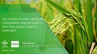
- 1. Co-creation with vertically integrated digital tools in the rice value chain in Vietnam Katie Nelson International Rice Research Institute October 5, 2023
- 2. Vietnam context Rice planted area • Vietnam: 7.57 million hectares • Mekong Delta: 4.11 million hectares VIETNAM IS 3RD LARGEST EXPORTER OF RICE GLOBALLY MORE THAN 13 MILLION RICE FARMERS IN MEKONG DELTA RICE PRODUCTION IS 3% OF VIETNAM’S GDP AND EMITS 15% OF TOTAL GHG EMISSIONS RICE FARMERS IN VIETNAM APPLY 20%-30% MORE FERTILIZER THAN RECOMMENDED ON AVERAGE, FARMERS USE OF PESTICIDES IS EXCESSIVE AND INACCURATE1 Source: Guan et al., 2016 Vietnam government is committed to a sustainable transition in rice: • 1 million hectare program for sustainable, low-emission rice (carbon credits) • NDC commitments Agricultural Transitions Digital Tools Project aims to reach 20,000 rice farmers in the Mekong Delta with inclusive digital tools
- 3. Digital Agriculture Profile - Vietnam Despite multiple farmer-oriented apps developed, only 3.3% of farmers use apps specifically designed for agriculture The same app designed for rice, pepper, and coffee documented 40-50% use by pepper and coffee farmers and less than 3% by rice farmers BUT
- 4. Working with different users to identify needs • Survey over 200 rice farmers and 60 field agents • Focus group discussions with farmers and field agents to test available apps • Joined 2 digital development teams for testing their apps with farmers • Stakeholder engagement forum to brainstorm innovations
- 6. Vertical integration of digital tools Digitized spatially explicit statistical reporting system of government (website) Field water level sensors (product) Performance assessment app or technical advisory (app, videos) Target users • Private companies producing rice or buying rice • Input suppliers • Farmer cooperatives • Extension agents • Advanced farmers • Researchers • Practitioners (project developers) • Farmers • Researchers • Irrigation service providers • Government officials at different levels – commune, province, regional, national • Researchers • Practitioners (project developers) • Investors Type of tool Use cases • Identify hotspots • National inventories • Develop incentive programs (carbon credits) • Guide investments/ policies • Identify areas for improvement • Enable certification • Access information to improve practices • Store information/ records • Connect farmers with incentive programs/ markets • Enable farmer decision- making • Safeguard losses • Information transfer • Store records Greenhouse gas calculator API
- 7. Digital ecosystem • Digitize the statistical reporting system to store data on farm management practices in a centralized database and enable spatial content • Develop a field agent app that is linked to the same system where data can be recorded at the field-level • Enable system so data is accessible to and can be sent via messenger app to beneficiaries • Alerts enabled to warn beneficiaries and provide guidance • Validate the aggregate data of the statistical reporting system • Enable carbon emission reduction incentivization • Benchmarks created for management practices
- 8. Field-level digital tool • Farmers get notifications by SMS of the field water level at the frequency they determine • Farmers can manage their field water level more accurately. Saves water, reduces GHG emissions. • Decision-support tool for farmers and/or irrigation service providers • The data can be used for added verification of emission reduction practices • Supports behavior change – water management practices are largely cultural and changes done correctly do not reduce yield