Welcome to the presentation on ‘total station
•Download as PPSX, PDF•
115 likes•78,777 views

![BASICS OF SURVEYING ,[object Object]](data:image/gif;base64,R0lGODlhAQABAIAAAAAAAP///yH5BAEAAAAALAAAAAABAAEAAAIBRAA7)
Recommended
More Related Content
What's hot
What's hot (20)
Similar to Welcome to the presentation on ‘total station
Similar to Welcome to the presentation on ‘total station (20)
Recently uploaded
Recently uploaded (20)
Welcome to the presentation on ‘total station
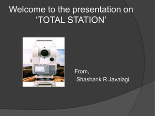
- 1. Welcome to the presentation on ‘TOTAL STATION’ From, Shashank R Javalagi.
- 3. The linear measurements and angular measurements are measured with the aid of few instruments, viz., tape, chain, staff, dumpy level, theodolite, etc
- 4. All the readings are noted in field books or survey records and kept as a hard copy and the calculations are done later in office
- 6. With these inventions, modern surveying practices came into existence.
- 7. Hence with modern surveying instruments, survey work will be precise, faster and less tedious.
- 8. All the readings are recorded automatically by the electronic instruments in a microprocessor and based on these readings; critical values are calculated by the microprocessor, at real time.
- 9. Hence, the data collected in microprocessor is directly transferred and stored in the computer as a softcopy.
- 11. INTRODUCTION TO TOTAL STATION The total station is an improvised version of modern surveying instruments such as EDM – Electronic distance measurement, auto level and digital level. Total station is a combination of an electronic theodolite and an electronic distance meter (EMD). This combination makes it possible to determine the coordinates of reflector by aligning the instrument’s cross hair on the reflector and simultaneously measuring the vertical and horizontal angles and slope distances. On board micro-processor in the instrument, takes care of recording, readings and the necessary computations. The data can be easily transferred to a computer where it can be used to generate map.
- 12. ROBOTIC TOTAL STATION The improvised total station by name ROBOTIC TOTAL STATION allows the operator to control the instrument from a distance via remote control. This eliminates the need of an assistant staff member, as the operator holds the reflector and controls the total station from the observed point.
- 13. FUNCTIONS OF TOTAL STATION: Coordinates determination: Total station determines the coordinates of an unknown point relative to the known coordinate by establishing a direct line of sight between the two points. Angles and distances are measured from the total station to points under survey and the coordinates of surveyed points relative to the total station position are calculated using trigonometry and triangulation. Some total stations have Global Navigation Satellite System (GNSS), which does not require direct line of sight to determine coordinates. Distance measurement: A total station has a small solid state emitter within the instrument’s optical path. They generate modulated microwave or infrared signals that are reflected by a prism reflector or the object under survey. The modulation pattern in the returning signal is read and interpreted by the computer in the total station. The distance is thus determined by emitting and receiving multiple frequencies and determining the integer number of wavelength, to the target, for each frequency.
- 14. Angular measurement: Most of the modern total stations have digital bar-codes on rotating glass cylinder that are installed within the instrument. Angle measurements is done through electro-optical scanning of these digital bar-codes. Data processing: The data recorded by the instrument may be downloaded from the theodolite to a computer and the application software in turn generates a map of the survey area. Many advanced models of total station have built-in micro-processor to record and compute distances, horizontal and vertical angles.
- 15. ADVANTAGES OF TOTAL STATION Most accurate and user friendly. Gives position of a point (x, y and z) w. r. t. known point (base point). EDM is fitted inside the telescope. Digital display. On board memory to store data and compatibility with computers. Measures distance and angles and displays coordinates, Auto level compensator is available. Can work in lesser visibility also. Can measure distances even without prismatic target for lesser distances. Is water proof. On board software are available. Total solution for surveying work.
- 16. APPLICATIONS OF TOTAL STATION IN VARITIES OF FIELDS: Mainly used by land surveyors. Used by archaeologists to record excavations. By Police, crime scene investigators, private accident re-constructionists and insurance companies to take measurements of scenes. IN CIVIL ENGG FIELD USED FOR: General purpose angle measurements. General purpose distance measurement. Provision of control surveys. Contour and detail mapping. Setting out and construction work.
- 17. AUXILIARY EQUIPMENTS REQUIRED: Targets or Prisms to accurately define the target point of a direction measurement. A data recorder if one is not integrated into the total station. A download cable and software on a PC to capture and process the captured digital data to produce contour and detail maps.
- 18. CONCLUSION Total station makes the measurements more accurate. Total station records the data on its inbuilt data recorder and generates maps within a fraction of time. Hence time consuming will be less and Total station made survey work easy. Hence TOTAL STATION IS A TOTAL SOLUTION FOR SURVEY WORK.
- 19. END
- 20. THANK YOU