SlideShare ist ein Scribd-Unternehmen logo
1 von 13
Downloaden Sie, um offline zu lesen
SURE 110 - Fundamentals of Surveying


                                  BASICS OF
                                  SURVEYING

                                   Robert Burtch
                                   Surveying Engineering Department
                                   Ferris State University


                           DEFINITION
                             The art and science of making such
                             measurements as are necessary to
                             determine the relative position of points
                             above, on, or beneath the surface of the
                             earth, or to establish such points in a
                             specified position
                             Surveyor needs understanding of
                               rigorous mathematical to analyze and
                               adjust
                               scientific principles underlying and
                               affecting measurements


Basics of Surveying                                                      1
SURE 110 - Fundamentals of Surveying


                           BRANCHES OF SURVEYING

                             Geodetic Surveying       Plane Surveying
                               Branch of surveying      Branch of surveying
                               in which account is      in which the surface
                               taken of figure and      of the earth is
                               size of earth            considered a plane
                                                        surface


                           PHASES OF SURVEYING

                             Field Work
                               Data procurement phase
                             Office Work – data are
                               Analyzed
                               Reduced to useful form by mathematical
                               calculations
                               Adjusted
                               Frequently converted to graphical mode of
                               expression


Basics of Surveying                                                            2
SURE 110 - Fundamentals of Surveying


                           KINDS OF SURVEYS
                             Property surveys
                               Determine boundary lines, location of
                               property corners, acquisition of data to
                               prepare land subdivisions
                             Route surveys
                               Designing and constructing engineering
                               projects associated with transportation and
                               communications
                             Industrial surveys
                               Surveys in aircraft and other industries
                               where accurate dimensional layouts
                               necessary


                           KINDS OF SURVEYS
                             Topographic surveys
                               Collect field data to prepare topographic
                               maps
                             Hydrographic surveys
                               Map shorelines of water bodies, chart
                               bottom areas of streams, lakes, harbors,
                               etc., measure flow of rivers, assess other
                               issues related to navigation and water
                               resources
                             Aerial surveys (photogrammetry)
                               Use photographs mounted in specially
                               designed planes


Basics of Surveying                                                          3
SURE 110 - Fundamentals of Surveying


                           KINDS OF SURVEYS
                             Mine surveys
                               Determine position of underground works
                               and surface mines, fix position and
                               direction of tunnels and shafts, define
                               surface boundaries
                             Construction surveys
                               Performed during building of structure or
                               project to fix elevations, horizontal position,
                               and dimensions
                             Control surveys
                               Provide basic horizontal and vertical
                               position data for engineering mission


                           KINDS OF SURVEYS
                             Final (“As Built”) survey
                               Tie in features that have just been
                               constructed to provide final record of
                               construction and to check that construction
                               has proceeded according to design plan


Basics of Surveying                                                              4
SURE 110 - Fundamentals of Surveying


                           BASIC SURVEY
                           MEASUREMENTS: DEFINITIONS
                                  Direction of gravity used as
                                  reference direction
                                       Vertical – means direction of gravity
                                       Horizontal – means direction
                                       perpendicular to gravity


                           SURVEY GEOGRAPHIC
                           REFERENCE   Latitude (φ)
                                                          Lines run east-west
                                                          parallel to equator
                                                          Max angle 90°
                                                          South latitudes
                                                          negative
                                                       Longitude (λ)
                                                          Lines run north south,
                                                          converge at poles
                                                          0° - Greenwich
                                                          Measured east and
                                                          west - 180° max angle
                                                          West longitude
                                                          negative


Basics of Surveying                                                                5
SURE 110 - Fundamentals of Surveying


                                                       Oblate Spheroid
                           DEFINITIONS                   Ellipsoid of
                                                         Revolution
                                                         Solid obtained by
                                                         rotating an ellipse on
                                                         its shorter axis
                                                         Idealized figure of
                                                         earth


                           DEFINITIONS
                             Level surface (geoid)
                               Continuous surface that is at all points
                               perpendicular to the direction of gravity
                               Can be thought of as the surface of large
                               body of water at complete rest (unaffected
                               by tides, etc.)
                             Elevation
                               Vertical distance above or below a given
                               reference level surface
                             Difference in elevation
                               Vertical distance between two level
                               surfaces containing the two points


Basics of Surveying                                                               6
SURE 110 - Fundamentals of Surveying


                                                      Vertical line
                           DEFINITIONS                   Line following direction
                                                         of gravity
                                                         Vertical line passing
                                                         through several different
                                                         points on surface of
                                                         earth do not intersect at
                                                         a common point
                                                         Vertical lines not
                                                         necessarily normal to
                                                         surface of the earth
                                                      Deflection of vertical
                                                         Angle between
                                                         perpendicular to geoid
                                                         and ellipsoid


                           DEFINITIONS
                             Horizontal line
                               Line perpendicular to vertical line at a point
                             Horizontal plane
                               Plane perpendicular to vertical line at point
                               Only 1 horizontal plane through a given
                               point
                             Vertical plane
                               Plane containing vertical line at the point
                               Infinite number of vertical planes as a
                               given point


Basics of Surveying                                                                  7
SURE 110 - Fundamentals of Surveying


                            DIRECTION
                               Azimuth- clockwise    Bearing – angle
                               angle from north to   measured from north
                               line                  or south to east or
                                                     west


                            ACCURACY & PRECISION

                      Accuracy –
                      closeness between
                      measurement and
                      “true” value
                      Precision –
                      closeness to one
                      another of a set of
                      repeated
                      observations


Basics of Surveying                                                        8
SURE 110 - Fundamentals of Surveying


                           ERRORS

                             No measurement free of error (except
                             counting)

                             Mistakes or blunders
                               Not really errors because they are usually
                               so gross in magnitude
                               Most common reason – carelessness
                               Must be discovered and eliminated


                           ERRORS
                             Systematic error
                               Occur according to a system which can be
                               expressed mathematically
                               Magnitude and sign can be determined
                               Follow definite pattern
                               Can be caused by observer, instrument,
                               environment
                             Random error
                               Error left after systematic error removed
                               May tend to cancel themselves


Basics of Surveying                                                         9
SURE 110 - Fundamentals of Surveying


                           UNITS OF LENGTH

                             Imperial units           SI units (meters)
                             (feet)                      Le Systeme
                                Usually                  Internationale d’Unites
                                subdivided into          (International System
                                decimal units in         of Units
                                surveying                Normally subdivided
                                Use of inches            into decimeter,
                                                         centimeter, millimeter


                           NORMAL PREFIXES FOR
                           METER
                                                        deci (d) 10-1
                             exa (E) 1018
                                                        centi (c) 10-2
                             peta (p) 1015
                                                        milli (m) 10-3
                             tera (t) 1012
                                                        micro (µ)10-6
                             giga (g) 109
                                                        nana (n) 10-9
                             mega (m) 106
                                                        pico (p) 10-12
                             kilo (k) 103
                                                        femto (f) 10-15
                             hecto (h) 102
                                                        atto (a) 10-18
                             deka (da) 101

                             Ex: kilometer = 1,000m     Ex: millimeter = 0.001m


Basics of Surveying                                                                10
SURE 110 - Fundamentals of Surveying


                           METRIC SYSTEM
                             1791 French Academy of Sciences
                             recommended metre to be
                             1/10,000,000th part of polar quadrant
                             passing through Paris
                             1799 Academy of Sciences developed
                             new standard – Metre of the Archives –
                             made of platinum 1 meter in length
                             1999 General Conference of Weights
                             and Measures adopts “International
                             Prototype Metre” – platinum & iridium
                             bar


                           METRIC SYSTEM

                             1960 National Prototype Meter –
                             1,650,763.73 wavelengths of Krypton 86
                             atom in a vacuum
                             1983 Conference Generale des Poids et
                             Mesures redefined meter as length of
                             the path traveled by light in a vacuum
                             during a time interval of 1/299792458 of
                             a second


Basics of Surveying                                                     11
SURE 110 - Fundamentals of Surveying


                           FEET-METER CONVERSION


                           FEET-METER CONVERSION
                             Ferdinand Hassler brought iron meter
                             bar to U.S. in 1805 for work with Coast
                             Survey
                             1866 Congress legalized use of metric
                             system
                             1893 – Mendenhall Order
                               Superintendent of Weight & Measures
                               1 meter = 39.37 inches (exact)
                               1 U.S. Yard = (3600/3927) meter (exact)


Basics of Surveying                                                      12
SURE 110 - Fundamentals of Surveying


                           FEET-METER CONVERSION
                             1959 U.S. & U.K. agreed that Imperial
                             units used in both countries should be
                             the same
                               Defined 1 Yard = 0.9144 metre (exact)
                               1 ft = 0.3048 m (exact)
                               1 inch = 25.4 mm (exact)
                               Did not change relationship established by
                               Congress – kept for surveying and called
                               U.S. Survey foot


Basics of Surveying                                                         13

Weitere ähnliche Inhalte

Was ist angesagt?

Surveying
SurveyingSurveying
SurveyingJNTUK
 
CE6404 ANNA UNIVERSITY Unit iv gps surveying
CE6404 ANNA UNIVERSITY Unit iv gps surveyingCE6404 ANNA UNIVERSITY Unit iv gps surveying
CE6404 ANNA UNIVERSITY Unit iv gps surveyingDr Gopikrishnan T
 
Dgps concept
Dgps conceptDgps concept
Dgps conceptegovindia
 
Lecture 1-aerial photogrammetry
Lecture 1-aerial photogrammetryLecture 1-aerial photogrammetry
Lecture 1-aerial photogrammetryVidhi Khokhani
 
Surveying,ADVANCE EQUIPMENT IN SURVEY
Surveying,ADVANCE EQUIPMENT  IN SURVEYSurveying,ADVANCE EQUIPMENT  IN SURVEY
Surveying,ADVANCE EQUIPMENT IN SURVEYPRAJWAL SHRIRAO
 
Survey i book
Survey i bookSurvey i book
Survey i book4fmath55
 
Differentiation between Global and Local Datum from Different aspect
Differentiation between Global and Local Datum from Different aspect Differentiation between Global and Local Datum from Different aspect
Differentiation between Global and Local Datum from Different aspect Nzar Braim
 
Triangulation and trilateration pdf...
Triangulation and trilateration pdf...Triangulation and trilateration pdf...
Triangulation and trilateration pdf...Gokul Saud
 
Lecture 02 types of surveying
Lecture 02 types of surveyingLecture 02 types of surveying
Lecture 02 types of surveyingRehan Hanif
 
Remote sensing in Civil Engineering
Remote sensing in Civil EngineeringRemote sensing in Civil Engineering
Remote sensing in Civil EngineeringManishkumar Dubey
 
GIS and GPS - applications in civil engg
GIS and GPS - applications  in civil enggGIS and GPS - applications  in civil engg
GIS and GPS - applications in civil enggPundlik Rathod
 
Dgps seminar
Dgps seminarDgps seminar
Dgps seminaranand0030
 
Total station topcon exp procedures
Total station topcon exp proceduresTotal station topcon exp procedures
Total station topcon exp proceduresNAGESH KUMAR GUTURU
 
Inclinometer by milan kumar rai
Inclinometer by milan kumar raiInclinometer by milan kumar rai
Inclinometer by milan kumar raiMilan Kumar Rai
 
Techniques of Land Surveying
Techniques of Land SurveyingTechniques of Land Surveying
Techniques of Land SurveyingVijay Meena
 

Was ist angesagt? (20)

Triangulation survey
Triangulation surveyTriangulation survey
Triangulation survey
 
Surveying
SurveyingSurveying
Surveying
 
Surveying and Leveling
Surveying and LevelingSurveying and Leveling
Surveying and Leveling
 
GIS & GPS PPt
GIS & GPS PPtGIS & GPS PPt
GIS & GPS PPt
 
CE6404 ANNA UNIVERSITY Unit iv gps surveying
CE6404 ANNA UNIVERSITY Unit iv gps surveyingCE6404 ANNA UNIVERSITY Unit iv gps surveying
CE6404 ANNA UNIVERSITY Unit iv gps surveying
 
Dgps concept
Dgps conceptDgps concept
Dgps concept
 
Lecture 1-aerial photogrammetry
Lecture 1-aerial photogrammetryLecture 1-aerial photogrammetry
Lecture 1-aerial photogrammetry
 
Surveying,ADVANCE EQUIPMENT IN SURVEY
Surveying,ADVANCE EQUIPMENT  IN SURVEYSurveying,ADVANCE EQUIPMENT  IN SURVEY
Surveying,ADVANCE EQUIPMENT IN SURVEY
 
Survey i book
Survey i bookSurvey i book
Survey i book
 
Differentiation between Global and Local Datum from Different aspect
Differentiation between Global and Local Datum from Different aspect Differentiation between Global and Local Datum from Different aspect
Differentiation between Global and Local Datum from Different aspect
 
Triangulation and trilateration pdf...
Triangulation and trilateration pdf...Triangulation and trilateration pdf...
Triangulation and trilateration pdf...
 
Lecture 02 types of surveying
Lecture 02 types of surveyingLecture 02 types of surveying
Lecture 02 types of surveying
 
Remote sensing in Civil Engineering
Remote sensing in Civil EngineeringRemote sensing in Civil Engineering
Remote sensing in Civil Engineering
 
GIS and GPS - applications in civil engg
GIS and GPS - applications  in civil enggGIS and GPS - applications  in civil engg
GIS and GPS - applications in civil engg
 
Dgps seminar
Dgps seminarDgps seminar
Dgps seminar
 
Total station topcon exp procedures
Total station topcon exp proceduresTotal station topcon exp procedures
Total station topcon exp procedures
 
Inclinometer by milan kumar rai
Inclinometer by milan kumar raiInclinometer by milan kumar rai
Inclinometer by milan kumar rai
 
Techniques of Land Surveying
Techniques of Land SurveyingTechniques of Land Surveying
Techniques of Land Surveying
 
3D Drone Surveying
3D Drone Surveying3D Drone Surveying
3D Drone Surveying
 
EDM and Total Stations
EDM and Total StationsEDM and Total Stations
EDM and Total Stations
 

Kürzlich hochgeladen

DevEX - reference for building teams, processes, and platforms
DevEX - reference for building teams, processes, and platformsDevEX - reference for building teams, processes, and platforms
DevEX - reference for building teams, processes, and platformsSergiu Bodiu
 
Nell’iperspazio con Rocket: il Framework Web di Rust!
Nell’iperspazio con Rocket: il Framework Web di Rust!Nell’iperspazio con Rocket: il Framework Web di Rust!
Nell’iperspazio con Rocket: il Framework Web di Rust!Commit University
 
Use of FIDO in the Payments and Identity Landscape: FIDO Paris Seminar.pptx
Use of FIDO in the Payments and Identity Landscape: FIDO Paris Seminar.pptxUse of FIDO in the Payments and Identity Landscape: FIDO Paris Seminar.pptx
Use of FIDO in the Payments and Identity Landscape: FIDO Paris Seminar.pptxLoriGlavin3
 
Gen AI in Business - Global Trends Report 2024.pdf
Gen AI in Business - Global Trends Report 2024.pdfGen AI in Business - Global Trends Report 2024.pdf
Gen AI in Business - Global Trends Report 2024.pdfAddepto
 
How to write a Business Continuity Plan
How to write a Business Continuity PlanHow to write a Business Continuity Plan
How to write a Business Continuity PlanDatabarracks
 
Unraveling Multimodality with Large Language Models.pdf
Unraveling Multimodality with Large Language Models.pdfUnraveling Multimodality with Large Language Models.pdf
Unraveling Multimodality with Large Language Models.pdfAlex Barbosa Coqueiro
 
TeamStation AI System Report LATAM IT Salaries 2024
TeamStation AI System Report LATAM IT Salaries 2024TeamStation AI System Report LATAM IT Salaries 2024
TeamStation AI System Report LATAM IT Salaries 2024Lonnie McRorey
 
Digital Identity is Under Attack: FIDO Paris Seminar.pptx
Digital Identity is Under Attack: FIDO Paris Seminar.pptxDigital Identity is Under Attack: FIDO Paris Seminar.pptx
Digital Identity is Under Attack: FIDO Paris Seminar.pptxLoriGlavin3
 
Advanced Computer Architecture – An Introduction
Advanced Computer Architecture – An IntroductionAdvanced Computer Architecture – An Introduction
Advanced Computer Architecture – An IntroductionDilum Bandara
 
Generative AI for Technical Writer or Information Developers
Generative AI for Technical Writer or Information DevelopersGenerative AI for Technical Writer or Information Developers
Generative AI for Technical Writer or Information DevelopersRaghuram Pandurangan
 
Time Series Foundation Models - current state and future directions
Time Series Foundation Models - current state and future directionsTime Series Foundation Models - current state and future directions
Time Series Foundation Models - current state and future directionsNathaniel Shimoni
 
What is DBT - The Ultimate Data Build Tool.pdf
What is DBT - The Ultimate Data Build Tool.pdfWhat is DBT - The Ultimate Data Build Tool.pdf
What is DBT - The Ultimate Data Build Tool.pdfMounikaPolabathina
 
Merck Moving Beyond Passwords: FIDO Paris Seminar.pptx
Merck Moving Beyond Passwords: FIDO Paris Seminar.pptxMerck Moving Beyond Passwords: FIDO Paris Seminar.pptx
Merck Moving Beyond Passwords: FIDO Paris Seminar.pptxLoriGlavin3
 
Developer Data Modeling Mistakes: From Postgres to NoSQL
Developer Data Modeling Mistakes: From Postgres to NoSQLDeveloper Data Modeling Mistakes: From Postgres to NoSQL
Developer Data Modeling Mistakes: From Postgres to NoSQLScyllaDB
 
What's New in Teams Calling, Meetings and Devices March 2024
What's New in Teams Calling, Meetings and Devices March 2024What's New in Teams Calling, Meetings and Devices March 2024
What's New in Teams Calling, Meetings and Devices March 2024Stephanie Beckett
 
Take control of your SAP testing with UiPath Test Suite
Take control of your SAP testing with UiPath Test SuiteTake control of your SAP testing with UiPath Test Suite
Take control of your SAP testing with UiPath Test SuiteDianaGray10
 
Dev Dives: Streamline document processing with UiPath Studio Web
Dev Dives: Streamline document processing with UiPath Studio WebDev Dives: Streamline document processing with UiPath Studio Web
Dev Dives: Streamline document processing with UiPath Studio WebUiPathCommunity
 
Rise of the Machines: Known As Drones...
Rise of the Machines: Known As Drones...Rise of the Machines: Known As Drones...
Rise of the Machines: Known As Drones...Rick Flair
 
The Fit for Passkeys for Employee and Consumer Sign-ins: FIDO Paris Seminar.pptx
The Fit for Passkeys for Employee and Consumer Sign-ins: FIDO Paris Seminar.pptxThe Fit for Passkeys for Employee and Consumer Sign-ins: FIDO Paris Seminar.pptx
The Fit for Passkeys for Employee and Consumer Sign-ins: FIDO Paris Seminar.pptxLoriGlavin3
 
What is Artificial Intelligence?????????
What is Artificial Intelligence?????????What is Artificial Intelligence?????????
What is Artificial Intelligence?????????blackmambaettijean
 

Kürzlich hochgeladen (20)

DevEX - reference for building teams, processes, and platforms
DevEX - reference for building teams, processes, and platformsDevEX - reference for building teams, processes, and platforms
DevEX - reference for building teams, processes, and platforms
 
Nell’iperspazio con Rocket: il Framework Web di Rust!
Nell’iperspazio con Rocket: il Framework Web di Rust!Nell’iperspazio con Rocket: il Framework Web di Rust!
Nell’iperspazio con Rocket: il Framework Web di Rust!
 
Use of FIDO in the Payments and Identity Landscape: FIDO Paris Seminar.pptx
Use of FIDO in the Payments and Identity Landscape: FIDO Paris Seminar.pptxUse of FIDO in the Payments and Identity Landscape: FIDO Paris Seminar.pptx
Use of FIDO in the Payments and Identity Landscape: FIDO Paris Seminar.pptx
 
Gen AI in Business - Global Trends Report 2024.pdf
Gen AI in Business - Global Trends Report 2024.pdfGen AI in Business - Global Trends Report 2024.pdf
Gen AI in Business - Global Trends Report 2024.pdf
 
How to write a Business Continuity Plan
How to write a Business Continuity PlanHow to write a Business Continuity Plan
How to write a Business Continuity Plan
 
Unraveling Multimodality with Large Language Models.pdf
Unraveling Multimodality with Large Language Models.pdfUnraveling Multimodality with Large Language Models.pdf
Unraveling Multimodality with Large Language Models.pdf
 
TeamStation AI System Report LATAM IT Salaries 2024
TeamStation AI System Report LATAM IT Salaries 2024TeamStation AI System Report LATAM IT Salaries 2024
TeamStation AI System Report LATAM IT Salaries 2024
 
Digital Identity is Under Attack: FIDO Paris Seminar.pptx
Digital Identity is Under Attack: FIDO Paris Seminar.pptxDigital Identity is Under Attack: FIDO Paris Seminar.pptx
Digital Identity is Under Attack: FIDO Paris Seminar.pptx
 
Advanced Computer Architecture – An Introduction
Advanced Computer Architecture – An IntroductionAdvanced Computer Architecture – An Introduction
Advanced Computer Architecture – An Introduction
 
Generative AI for Technical Writer or Information Developers
Generative AI for Technical Writer or Information DevelopersGenerative AI for Technical Writer or Information Developers
Generative AI for Technical Writer or Information Developers
 
Time Series Foundation Models - current state and future directions
Time Series Foundation Models - current state and future directionsTime Series Foundation Models - current state and future directions
Time Series Foundation Models - current state and future directions
 
What is DBT - The Ultimate Data Build Tool.pdf
What is DBT - The Ultimate Data Build Tool.pdfWhat is DBT - The Ultimate Data Build Tool.pdf
What is DBT - The Ultimate Data Build Tool.pdf
 
Merck Moving Beyond Passwords: FIDO Paris Seminar.pptx
Merck Moving Beyond Passwords: FIDO Paris Seminar.pptxMerck Moving Beyond Passwords: FIDO Paris Seminar.pptx
Merck Moving Beyond Passwords: FIDO Paris Seminar.pptx
 
Developer Data Modeling Mistakes: From Postgres to NoSQL
Developer Data Modeling Mistakes: From Postgres to NoSQLDeveloper Data Modeling Mistakes: From Postgres to NoSQL
Developer Data Modeling Mistakes: From Postgres to NoSQL
 
What's New in Teams Calling, Meetings and Devices March 2024
What's New in Teams Calling, Meetings and Devices March 2024What's New in Teams Calling, Meetings and Devices March 2024
What's New in Teams Calling, Meetings and Devices March 2024
 
Take control of your SAP testing with UiPath Test Suite
Take control of your SAP testing with UiPath Test SuiteTake control of your SAP testing with UiPath Test Suite
Take control of your SAP testing with UiPath Test Suite
 
Dev Dives: Streamline document processing with UiPath Studio Web
Dev Dives: Streamline document processing with UiPath Studio WebDev Dives: Streamline document processing with UiPath Studio Web
Dev Dives: Streamline document processing with UiPath Studio Web
 
Rise of the Machines: Known As Drones...
Rise of the Machines: Known As Drones...Rise of the Machines: Known As Drones...
Rise of the Machines: Known As Drones...
 
The Fit for Passkeys for Employee and Consumer Sign-ins: FIDO Paris Seminar.pptx
The Fit for Passkeys for Employee and Consumer Sign-ins: FIDO Paris Seminar.pptxThe Fit for Passkeys for Employee and Consumer Sign-ins: FIDO Paris Seminar.pptx
The Fit for Passkeys for Employee and Consumer Sign-ins: FIDO Paris Seminar.pptx
 
What is Artificial Intelligence?????????
What is Artificial Intelligence?????????What is Artificial Intelligence?????????
What is Artificial Intelligence?????????
 

SURE 110 Fundamentals of Surveying Basics

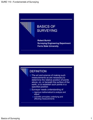
  • 1. SURE 110 - Fundamentals of Surveying BASICS OF SURVEYING Robert Burtch Surveying Engineering Department Ferris State University DEFINITION The art and science of making such measurements as are necessary to determine the relative position of points above, on, or beneath the surface of the earth, or to establish such points in a specified position Surveyor needs understanding of rigorous mathematical to analyze and adjust scientific principles underlying and affecting measurements Basics of Surveying 1
  • 2. SURE 110 - Fundamentals of Surveying BRANCHES OF SURVEYING Geodetic Surveying Plane Surveying Branch of surveying Branch of surveying in which account is in which the surface taken of figure and of the earth is size of earth considered a plane surface PHASES OF SURVEYING Field Work Data procurement phase Office Work – data are Analyzed Reduced to useful form by mathematical calculations Adjusted Frequently converted to graphical mode of expression Basics of Surveying 2
  • 3. SURE 110 - Fundamentals of Surveying KINDS OF SURVEYS Property surveys Determine boundary lines, location of property corners, acquisition of data to prepare land subdivisions Route surveys Designing and constructing engineering projects associated with transportation and communications Industrial surveys Surveys in aircraft and other industries where accurate dimensional layouts necessary KINDS OF SURVEYS Topographic surveys Collect field data to prepare topographic maps Hydrographic surveys Map shorelines of water bodies, chart bottom areas of streams, lakes, harbors, etc., measure flow of rivers, assess other issues related to navigation and water resources Aerial surveys (photogrammetry) Use photographs mounted in specially designed planes Basics of Surveying 3
  • 4. SURE 110 - Fundamentals of Surveying KINDS OF SURVEYS Mine surveys Determine position of underground works and surface mines, fix position and direction of tunnels and shafts, define surface boundaries Construction surveys Performed during building of structure or project to fix elevations, horizontal position, and dimensions Control surveys Provide basic horizontal and vertical position data for engineering mission KINDS OF SURVEYS Final (“As Built”) survey Tie in features that have just been constructed to provide final record of construction and to check that construction has proceeded according to design plan Basics of Surveying 4
  • 5. SURE 110 - Fundamentals of Surveying BASIC SURVEY MEASUREMENTS: DEFINITIONS Direction of gravity used as reference direction Vertical – means direction of gravity Horizontal – means direction perpendicular to gravity SURVEY GEOGRAPHIC REFERENCE Latitude (φ) Lines run east-west parallel to equator Max angle 90° South latitudes negative Longitude (λ) Lines run north south, converge at poles 0° - Greenwich Measured east and west - 180° max angle West longitude negative Basics of Surveying 5
  • 6. SURE 110 - Fundamentals of Surveying Oblate Spheroid DEFINITIONS Ellipsoid of Revolution Solid obtained by rotating an ellipse on its shorter axis Idealized figure of earth DEFINITIONS Level surface (geoid) Continuous surface that is at all points perpendicular to the direction of gravity Can be thought of as the surface of large body of water at complete rest (unaffected by tides, etc.) Elevation Vertical distance above or below a given reference level surface Difference in elevation Vertical distance between two level surfaces containing the two points Basics of Surveying 6
  • 7. SURE 110 - Fundamentals of Surveying Vertical line DEFINITIONS Line following direction of gravity Vertical line passing through several different points on surface of earth do not intersect at a common point Vertical lines not necessarily normal to surface of the earth Deflection of vertical Angle between perpendicular to geoid and ellipsoid DEFINITIONS Horizontal line Line perpendicular to vertical line at a point Horizontal plane Plane perpendicular to vertical line at point Only 1 horizontal plane through a given point Vertical plane Plane containing vertical line at the point Infinite number of vertical planes as a given point Basics of Surveying 7
  • 8. SURE 110 - Fundamentals of Surveying DIRECTION Azimuth- clockwise Bearing – angle angle from north to measured from north line or south to east or west ACCURACY & PRECISION Accuracy – closeness between measurement and “true” value Precision – closeness to one another of a set of repeated observations Basics of Surveying 8
  • 9. SURE 110 - Fundamentals of Surveying ERRORS No measurement free of error (except counting) Mistakes or blunders Not really errors because they are usually so gross in magnitude Most common reason – carelessness Must be discovered and eliminated ERRORS Systematic error Occur according to a system which can be expressed mathematically Magnitude and sign can be determined Follow definite pattern Can be caused by observer, instrument, environment Random error Error left after systematic error removed May tend to cancel themselves Basics of Surveying 9
  • 10. SURE 110 - Fundamentals of Surveying UNITS OF LENGTH Imperial units SI units (meters) (feet) Le Systeme Usually Internationale d’Unites subdivided into (International System decimal units in of Units surveying Normally subdivided Use of inches into decimeter, centimeter, millimeter NORMAL PREFIXES FOR METER deci (d) 10-1 exa (E) 1018 centi (c) 10-2 peta (p) 1015 milli (m) 10-3 tera (t) 1012 micro (µ)10-6 giga (g) 109 nana (n) 10-9 mega (m) 106 pico (p) 10-12 kilo (k) 103 femto (f) 10-15 hecto (h) 102 atto (a) 10-18 deka (da) 101 Ex: kilometer = 1,000m Ex: millimeter = 0.001m Basics of Surveying 10
  • 11. SURE 110 - Fundamentals of Surveying METRIC SYSTEM 1791 French Academy of Sciences recommended metre to be 1/10,000,000th part of polar quadrant passing through Paris 1799 Academy of Sciences developed new standard – Metre of the Archives – made of platinum 1 meter in length 1999 General Conference of Weights and Measures adopts “International Prototype Metre” – platinum & iridium bar METRIC SYSTEM 1960 National Prototype Meter – 1,650,763.73 wavelengths of Krypton 86 atom in a vacuum 1983 Conference Generale des Poids et Mesures redefined meter as length of the path traveled by light in a vacuum during a time interval of 1/299792458 of a second Basics of Surveying 11
  • 12. SURE 110 - Fundamentals of Surveying FEET-METER CONVERSION FEET-METER CONVERSION Ferdinand Hassler brought iron meter bar to U.S. in 1805 for work with Coast Survey 1866 Congress legalized use of metric system 1893 – Mendenhall Order Superintendent of Weight & Measures 1 meter = 39.37 inches (exact) 1 U.S. Yard = (3600/3927) meter (exact) Basics of Surveying 12
  • 13. SURE 110 - Fundamentals of Surveying FEET-METER CONVERSION 1959 U.S. & U.K. agreed that Imperial units used in both countries should be the same Defined 1 Yard = 0.9144 metre (exact) 1 ft = 0.3048 m (exact) 1 inch = 25.4 mm (exact) Did not change relationship established by Congress – kept for surveying and called U.S. Survey foot Basics of Surveying 13