

Empfohlen
Empfohlen
Weitere ähnliche Inhalte
Andere mochten auch
Andere mochten auch (19)
Ähnlich wie Visualising data
Ähnlich wie Visualising data (20)
Mehr von Library Research Services
Mehr von Library Research Services (17)
Visualising data
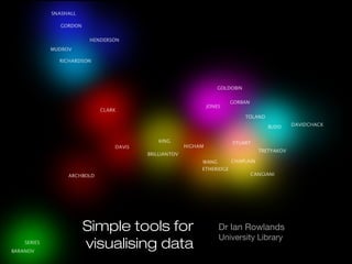
- 1. Simple tools for Dr Ian Rowlands University Library visualising data
- 3. Some easy-to-use visualisation tools • Find data patterns with Excel conditional formatting • Map your data with OpenHeatMap • Create infographics with Piktochart • Animate our data with Google Motion Charts • Visualise networks with VOSviewer
- 4. Some easy-to-use visualisation tools • Find data patterns with Excel conditional formatting • Map your data with OpenHeatMap • Create infographics with Piktochart • Animate our data with Google Motion Charts • Visualise networks with VOSviewer
- 5. Some easy-to-use visualisation tools • Find data patterns with Excel conditional formatting • Map your data with OpenHeatMap • Create infographics with Piktochart • Animate our data with Google Motion Charts • Visualise networks with VOSviewer
- 6. Some easy-to-use visualisation tools • Find data patterns with Excel conditional formatting • Map your data with OpenHeatMap • Create infographics with Piktochart • Visualise networks with VOSviewer
- 7. Find data patterns with Excel conditional formatting
- 8. Excel conditional formatting • What you need • A copy of Excel 2000 (Windows or Mac OS X) • Some spreadsheet data (numbers, text, or both) • Time to explore e es ity th • A colour printer, ideally i c rs y Le ve d b r te o ni e U d vi ro P f
- 9. Excel conditional formatting • What you can do with it • Identify duplicates or unique values • Highlight cells according to rules you define (e.g. top 10%, above average) • Add data bars to cells • Add icon sets (e.g. traffic lights to show values above and below user-defined thresholds) • ... essentially a tool to explore tabular data and to help you and your readers to pick out what really matters
- 11. Map your data with OpenHeatMap
- 12. OpenHeatMap • What you need • A good internet connection and a browser • OpenHeatMap is a free cloud application so you don’t need to download or install any other software: just upload your data onto their remote server • No need to register or sign in ti d u n • Spreadsheet data where the first column ca o o contains a spatial reference (e.g. country li l p c names, UK councils, US zip codes) and the p e other columns contain numerical information a re that you want to project onto a map F
- 13. OpenHeatMap • What you can do with it • Project any data that comprises a location and a number onto a zoomable map • ... offers a more meaningful way to present spatial data
- 14. OpenHeatMap location plus data • Data format country wine production* Italy 46,245 France 42,582 Spain 41,583 Germany 9,991 Romania 6,786 Portugal 5,620 *1,000 hectolitres in 2011/12
- 15. OpenHeatMap examples of locations supported
- 16. OpenHeatMap www.openheatmap.com Text
- 17. OpenHeatMap Text
- 19. Piktochart • What you need ll d fu u • A good internet connection and a browser o (U s s; cl • A debit or credit card! o ir ic e 9) ti u v th • Time and creativity .9 n e e p q er n S$ a 29 ri re s o sc e d ss it ce su rv m c b ic e se li a e re F to
- 20. Piktochart • What you can do with it • Create an infographic and tell a story using numbers • Summarise and present a lot of complex information on a single sheet • Design principles are already embedded in templates: you do not need to be a graphic artist! • ... a great way to clear your head and really get to the nub of what you are trying to say (and impress)
- 21. Piktochart
- 22. Piktochart
- 23. Piktochart piktochart.com
- 25. VOSviewer • What you need • Free software download at www.vosviewer.com • Java 6 or higher must be installed x) u o ad n • Spreadsheet data, saved as .csv or .txt Li a lo r • You can also import Web of Science records M wn (remember to check the full cited records option c s, o and select .txt) w d o e d re in F (W
- 26. VOSviewer • What you can do with it • Make the relationships between members of a network visible • Import search results from the Web of Science and automatically generate maps of the literature • Explore relationships between papers, journals, authors and institutions • ... understand the structure of complex networks, revealing hidden relationships
- 27. Exporting from Web of Science
- 31. VOSviewer