
Empfohlen
Empfohlen
Weitere ähnliche Inhalte
Was ist angesagt?
Was ist angesagt? (19)
Ähnlich wie Transit sketch planning (webinar slides)
Ähnlich wie Transit sketch planning (webinar slides) (20)
Mehr von garrjacobs
Mehr von garrjacobs (9)
Kürzlich hochgeladen
Kürzlich hochgeladen (20)
Transit sketch planning (webinar slides)
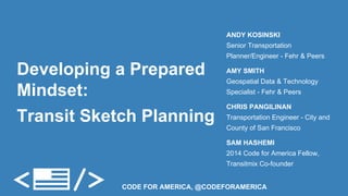
- 1. Developing a Prepared Mindset: Transit Sketch Planning ANDY KOSINSKI Senior Transportation Planner/Engineer - Fehr & Peers AMY SMITH Geospatial Data & Technology Specialist - Fehr & Peers CHRIS PANGILINAN Transportation Engineer - City and County of San Francisco SAM HASHEMI 2014 Code for America Fellow, Transitmix Co-founder CODE FOR AMERICA, @CODEFORAMERICA
- 2. Outline for the hour ● Competing Goals within Transit Planning ● Key Transit Planning Considerations (political, budgetary…) ● Spatial Datasets (using them to inform community goals) ● Transitmix (Demo and discussion of the multifaceted tool) ● Q & A
- 3. Competing Goals ● Unlimited Possibilities ● Limited Resources ● What is your goal?
- 4. What’s your goal? ● Maximize Ridership Photo Credit: Michael Ocampo
- 5. What’s your goal? ● Maximize Coverage (Lifeline) Photo Credit: Julian Walker
- 6. San Francisco ● Route 54
- 8. Route 54 ● Proposed adjustment Photo Credit: Jarrett Walker & TEI, Inc.
- 9. Houston ● Current frequent network Photo Credit: Jarrett Walker & TEI, Inc.
- 10. Houston ● Proposed frequent network Photo Credit: Jarrett Walker & TEI, Inc.
- 11. What is your goal? ● Set ridership and coverage goals to meet the needs of your communities ● Be clear about these as you design your network Further reading: Jarrett Walker. Purpose-driven public transport: creating a clear conversation about public transport goals. Journal of Transport Geography 16 (2008) 436–442.
- 12. Key Transit Planning Considerations ● Budgetary components ● Roadway engineering - Operating Costs ● Tradeoff case study
- 13. Transit Budgetary Components Capital Costs Operating Costs
- 14. Operating Cost Breakdown Source: APTA & National Transit Database, 2010
- 15. Operating Cost Example Operating Cost Scenarios for 16 hours of service, 250 days per year Infrequent service: 100 minute cycle, 20 minute headways → 5 buses needed ($2.4M/year) Frequent service: 100 minute cycle, 5 minute headways → 20 buses needed ($9.6M/year) Frequent, delayed service: 115 minute cycle, 5 minute headways → ($11.04M/year) Delays cost $1.44M every year for one route!
- 16. Engineering to reduce operating costs
- 17. San Francisco Tradeoff Study What happens if we reroute the 54 bus due to resident complaints? Planning and operational considerations
- 18. San Francisco Tradeoff Study
- 19. Spatial Data Resources ● Smart Location Database ● National Household Travel Survey ● Automatic Vehicle Location
- 20. EPA Smart Location Database What it is | Nationwide database of transportation characteristics Geography | Census Block Group Find It | www.epa.gov/smartgrowth/smartlocationdatabase.htm
- 21. EPA Smart Location Database
- 22. EPA Smart Location Database
- 23. National Household Travel Survey What it is | Data on travel and transportation patterns in the US Geography | Various Census Geographies Find It | NHTS http://nhts.ornl.gov CHTS http://www.dot.ca.gov/hq/tpp/offices/otfa/national_household_travel_survey.html
- 24. National Household Travel Survey
- 25. National Household Travel Survey
- 26. Automatic Vehicle Location (AVL) What it is | Vehicle locations, often collected using GPS Geography | Time-stamped coordinates (Latitude/Longitude) Find It | Local transit providers, NextBus XML feed
- 27. Automatic Vehicle Location (AVL)
- 28. Working with Spatial Data ● Starting at the end and knowing your goal ● Starting from the data and exploring ● Knowing your scale ● Asking questions and understanding limitations
- 29. Transitmix ● Modern mapping tool for planning transit ● http://transitmix.net ● @transitmix ● team@transitmix.net
- 31. LIVE APP app.transitmix.net 1-MIN DEMO vimeo.com/105403827 6-MIN OVERVIEW youtube.com/watch? v=enMF-bbQOp8 Demo
- 33. Coming Soon: Transitmix Pro GTFS Geospatial Layers Title VI Analysis Lots more! Interested? Please reach out to us! team@transitmix.net
- 34. Thank You! Q&A ANDY KOSINSKI Senior Transportation Planner/ Engineer - Fehr & Peers AMY SMITH Geospatial Data & Technology Specialist - Fehr & Peers CHRIS PANGILINAN Transportation Engineer - City and County of San Francisco SAM HASHEMI 2014 Code for America Fellow, Transitmix Co-founder GARRETT JACOBS Facilitator - CfA @andykosinski @wolfmapper @cap_transport @oksamuel @garrjacobs