SlideShare ist ein Scribd-Unternehmen logo
1 von 13
Downloaden Sie, um offline zu lesen
Digital Enterprise Research Institute                                                                                    www.deri.ie


                        Towards the Integration of Spatiotemporal
                        Sensor Data and User-Generated Content


                                           Cornelius Rabsch • cornelius@rabsch.net


                                                                               Chapter
 Copyright 2008 Digital Enterprise Research Institute. All rights reserved.


“Towards the Integration of Spatiotemporal User-Generated Content and Sensor Data” by C. Rabsch

Abstract:
Pervasive sensor networks are the source of continuous data streams about our physical environment. With the rise of the Mobile
Web people-centric sensing yields a new layer of spatiotemporal contextual data, from qualitative user-generated content (e.g. geo-
referenced multimedia messages) to quantitative sensor measurements (e.g. earthquake or hazard alerts). This mobile sensed
content is made accessible within an ecosystem of heterogenous service providers, from social networks to social data networks.
The mining, analysis and processing of these streams provides many challenges and semantic technologies can be utilized to
overcome this heterogeneity. The integration of sensor data with a user-generated context will provide an increased situational
awareness and contextual knowledge, resulting in application scenarios from more efficient emergency response management to
improved urban planning.

This talk gives an overview of the research I am doing at the Digital Enterprise Research Institute as part of my final thesis for my
studies of Business Administration and Computer Science (Diploma degree, equivalent to a Master) at the University of Mannheim,
Germany. A detailed presentation about the spatiotemporal data integration steps and formalisms will be published at a later stage.

Alternative title:
“A geospatial activity-based approach to semantically link user-generated content and sensor data.”

Thesis supervision by:
Prof. Dr. Manfred Hauswirth - Sensor Middleware Unit, Digital Enterprise Research Institute, National University of Ireland, Galway -
www.deri.ie
Prof. H. Stuckenschmidt - Knowledge Representation and Knowledge Management Research Group, University of Mannheim,
Germany - ki.informatik.uni-mannheim.de

Index terms:
people-centric sensing, mobile sensing, user-generated content, sensor data, spatiotemporal integration

Contact: Cornelius Rabsch - cornelius@rabsch.net - http://www.inperspektive.com
Ubiquitous Mobile Sensing
Digital Enterprise Research Institute                                                                                  www.deri.ie


                         Source: National Research Council USA


                                                          Source: Nokia Research Center, 2008 [1]


The global trends of pervasive sensor networks and sensors embedded into everyday devices goes along with a steadily increasing
number of deployed mobile devices, already reaching over 4 billion in 2009 [1]. Sensors and mobile phones are highly connected by
the fact that every modern phone embeds a variety of sensors: location, acoustical, light or orientation, for example. According to
Nokia Research Center [1] there will be a shift from traditional sensor networks to a participatory sensing infrastructure that
leverages available devices and puts humans in the loop. Thus leading to a sensing network utilizing people and their mobility.
Mobile sensing is the origin for large heterogeneous spatiotemporal data sets that have to be mined, processed and analyzed which
provides challenging tasks and complex problems.

[1] Nokia Research Center, Sensing the World with Mobile Devices, http://research.nokia.com/files/insight/NTI_Sensing_-
_Dec_2008.pdf, 2008
Sensors + Mobile Phones + People
Digital Enterprise Research Institute                                                                                     www.deri.ie


To give an overview of the main concepts we take a closer look at sensors connected to mobile phones, people carrying mobile
phones and mobile phones as place of origin for user-generated content and sensor data.

Looking solely at networked sensors, we have a well understood infrastructure where sensors are part of sensor networks and
sensor bases or social data networks can provide a persistence layer with varying degrees of data accessibility. Providers for this
kind of service are Sensorbase [2], Sensorpedia [3] or Pachube [4], for example. Sensor middleware can be utilized to collect,
process and analyze large amounts of sensor data.

On the other hand, people in a networked world are part of online communities and create content within social networks. All user-
generated content
in Social Media is distributed over a variety of heterogeneous services. Photo community Flickr [5], video community YouTube [6] or
generic social network Facebook [7], for example. These services act as valuable centralized places to collect and analyze social
media contributions.

Bridging the quantitative sensor world with the human-centric social media world is a challenging task. Mobile phones can play an
important role as the place of origin for user-generated content and sensor data. The concept of mobile sensing is focusing on the
mobile devices and its embedded sensors. Humans are seen as carriers providing the mobility which results in an opportunistic
sensing infrastructure [1].

In both scenarios, sensors embedded into mobile phones and people submitting content with mobile phones, the networking aspect
is essential and Internet connectivity is enabler to exchange and aggregate data. The Internet and the World Wide Web in specific
provide a scalable infrastructure with shared well-accepted standards and technologies and thus build a ready-to-use foundation
and platform for data distribution, mining and analysis.

The specifics of data sharing around the aspects of provenance, trust, permissions and access rights wonʼt be in the focus of this
research.

[1] Lane et al., Urban sensing systems: opportunistic or participatory?, 9th workshop on Mobile computing systems, 2008,
www.cl.cam.ac.uk/~mm753/papers/hotmobile08.pdf
[2] Sensorbase.org
[3] Sensorpedia.org
[4] Pachube.com
[5] Flickr.com
[6] Youtube.com
[7] Facebook.com
[8] Campbell et al., The Rise of People-Centric Sensing. Internet Computing, IEEE (2008) vol. 12 (4) pp. 12 - 21
Mobile + Sensors
Digital Enterprise Research Institute                                                                                       www.deri.ie


                                                                                            BioMapping.net by C. Nold


  NoiseTube, SONY Computer
  Science Laboratory


                                               CitySense, SenseNetworks

                                                                                            Real Time Rome, MIT SENSEable City Lab


We follow by giving a short overview about typical mobile sensing scenarios to clarify how mobile devices can be used to sense
your physical environment.

The NoiseTube project “turns your mobile phone into an environmental sensor and participates to the monitoring of noise
pollution” [1]. Users can also annotate the sensed data with tags as ʻConstruction buildingʼ to give more background with the sensed
location.

CitySense [2] is built on top of Sense Networksʼ Macrosense location analytics platform [3] to report about nightlife activity in San
Francisco by analyzing location traces and consumer behavior.

BioMapping [4] measures the Galvanic Skin Response (GSR) to recognize emotional arousal at specific places as bridges or hard-
to-cross streets.

The Real Time Rome project [5] by the MIT SENSEable City Lab [6] analyzes cell phone data within the city of Rome to figure out
consumer behavior and finding patterns in urban data collections [7].

Goal of these sensing application can be the utilization and analysis of the sensed data to influence human behavior, e.g. where to
go next, which places have to be avoided, how to select the fasted path to a specific place, for example.

[1] NoiseTube by SONY Computer Science Laboratory, http://noisetube.net/
[2] CitySense, Sense Networks, http://www.citysense.com, “Life San Francisco Nightlife Activity”
[3] MacroSense, Sense Networks, http://www.sensenetworks.com/macrosense.php
[4] BioMapping, C. Nold, http://biomapping.net
[5] Real Time Rome, MIT SENSEable City Lab, http://senseable.mit.edu/realtimerome/
[6] MIT SENSEable City Lab, http://senseable.mit.edu/
[7] Reades et al., Cellular Census: Explorations in Urban Data Collection, Pervasive Computing, IEEE (2007) Vol. 6 (3) pp. 30 - 38
Mobile + People
Digital Enterprise Research Institute                                                                                      www.deri.ie


                                                         Source: twitter.com/arunshanbhag


                                                                             “There’s a plane in the Hudson. i’m on the
                                                                             ferry going to pick up people. Crazy.”
   Source: www.flickr.com/photos/vinu
                                                                                                     Source: twitpic.com/135xa


User-generated content, also referred as social media contributions, can be personal, entertaining, of uncertain quality, timely,
contextual and often unpredictable. For the sake of simplicity and convincingness we give an overview of typical contributions of high
importance and high quality. Citizen journalism refers to the act of citizens reporting about their neighborhood and the community
they are living in, ranging from hyper-local news to on-the-spot emergency reports. The tools that facilitate citizen journalism are
manifold and often free and easy to use.

User ʻarunshanbhagʼ reports about a terrorist attack at the Taj Hotel in Mumbai [1] by using the micro-blogging service Twitter, user
ʻvinuʼ on Flickr uploads and geo-references a photo about the same event with only a minor delay [2], user ʻjkrumsʼ is witnessing a
plane crash and immediately takes a picture which got tens of thousands of views on Twitpic [3], to name a few real-life citizen
journalism examples.

Mobile mapping of earthquake catastrophes [4] is another example where it is important to know at which places a house is burning
or where it collapsed and how big the impact was.

It is important to note that location often matters and user-generated content is in many cases already geo-referenced by utilizing
built-in GPS sensors in mobile phones or by manually selecting the correct location on a web mapping interface.

[1] “Mumbai Blasts”, Twitter user arunshanbhag, http://twitter.com/arunshanbhag, accessed April 2009
[2] “Mumbai Attacks on Nov 26th 2008”, Flickr user vinu, http://www.flickr.com/photos/vinu/sets/72157610144709049/, accessed April
2009
[3] “US Airways Hudson River Plane Crash”, Twitpic user jkums, http://twitpic.com/135xa, accessed April 2009
[4] “Earthquake LʼAquilla”, Google Maps user TMG, http://maps.google.com/maps/ms?
msa=0&msid=112463924814795169379.000466dc7c10ff9a99bd4&ie=UTF8&ll=42.3496,13.397613&spn=0.013638,0.032187&t=p&
z=15, accessed April 2009
Related Work
Digital Enterprise Research Institute                                                                                     www.deri.ie


                                                                                                         References: see slide notes


To distinguish the related work we use a) a breakdown by type of content and b) a breakdown by the heterogeneity. The types of
data can be user-generated content, sensor data or scenarios where both are considered for integration and analysis. With regards
to the heterogeneity, the distinction is between a closed world scenario where one or multiple well-known data sources are applied
and an open world scenario where multiple heterogeneous data sources are applied. The latter provides a much higher complexity
because of the missing semantic interoperability between service providers and their data schemas.

The focus lies on the data integration and analysis of spatiotemporal user-generated content and sensor data in a mobile context.

Note: Will be clarified and regrouped later on.

[1] Eagle and Pentland, Reality mining: sensing complex social systems. Personal and Ubiquitous Computing, 2006
[2] Sheth et al., Semantic Sensor Web, IEEE Internet Computing, 2008
[3] Calabrese et al., Wikicity: Real-time Location-sensitive Tools For The City, IEEE Pervasive Computing, 2007
[4] Girardin et al., Digital Footprinting: Uncovering Tourists with User-Generated Content, IEEE Pervasive Computing, vol. 7 (4) pp.
36 - 43, 2008
[5] Urban Sensing, CENS/UCLA, Center for Embedded Networked Sensing, http://urban.cens.ucla.edu/
[6] PEIR, the Personal Environmental Impact Report, http://urban.cens.ucla.edu/projects/peir/
[7] Real Time Rome, MIT SENSEable City Lab, http://senseable.mit.edu/realtimerome/
[8] Sensorbase.org
[9] Sensorpedia.org
[10] Pachube.com
[11] SIOC, Semantically-Interlinked Online Communities, http://sioc-project.org/
[12] BioMapping, C. Nold, http://biomapping.net
[13] NoiseTube by SONY Computer Science Laboratory, http://noisetube.net/
Research Questions
Digital Enterprise Research Institute                                                                                       www.deri.ie


            How can spatiotemporal user-generated content be
       
            semantically linked to sensor data?

            What kind of semantics are required to describe,
       
            analyze and query heterogenous geospatial activities?

         How can we increase and assess the contextual
       
         information provided by sensor data and user-
         generated content?
        Why? Increased eficiency in emergency response management, urban planning or
            targeted advertising,...


The focus will be on data access and data integration in a scenario where the dataʼs life-cycle is important to understand, i. e.
mobile-originated web-accessible content provided by heterogenous services.
Geospatial Activity Semantics
Digital Enterprise Research Institute                                                                                    www.deri.ie


                               *
                             *M. Perry. A framework to support spatial, temporal and thematic analytics over semantic web data, 2008


The underlying concepts of the geospatial activity vocabulary are the shared semantics of time, space and theme [1] of the user-
generated content and the sensor data. GeoAct is a vocabulary utilizing Semantic Web technologies as RDF for the representation
of spatiotemporal thematic data. RDF provides the basis for easy to use extension and integration mechanisms.

The red circles show common vocabularies as FOAF, Dublin Core or SIOC that can be interlinked to the GeoAct Activity base class.
A gazetteer schema as the one of Geonames [2] can be utilized to refer GPS coordinates to well-known geographical identifiers as
a way to geographically cluster activity data.

This section and the following about the GeoAct schema and the underlying concepts will be reviewed in detail in a different
presentation.

[1] Sheth and Perry, Traveling the Semantic Web through Space, Time, and Theme, IEEE Internet Computing, 2008
[2] http://www.geonames.org/
Activity Example as RDF/XML
Digital Enterprise Research Institute                                                                                www.deri.ie


                                                                                Semantic Gap!
                                                                                RDF / Atom Triples?


  Atom / RSS Feed Content: Earthquakes, Hazards, Weather, Traffic, Photos, Multimedia, Messages, Events,...


A sample RDF/XML extract of a geoact:Activity class about an earthquake notification as provided by the U.S. Geological Survey.

The semantic gap shows that more specific semantics of the earthquake notification and the seismic waves sensors are hidden in
non-structured text. A solution are more domain-specific ontologies extending the GeoAct vocabulary.

Web feeds (Atom or RSS with GeoRSS extensions) are already providing a variety of activity information from earthquakes to
hazards to multimedia messages or event information.

Sample feed sources for New York City, USA:
USGS M2.5+ Earthquakes

       http://earthquake.usgs.gov/eqcenter/catalogs/1day-M2.5.xml
Brightkite Place Stream

       http://brightkite.com/places/ede07eeea22411dda0ef53e233ec57ca/objects.rss?limit=100filters=notes,photos
Flickr Photo Stream

       http://www.flickr.com/services/feeds/geo/?tags=newyork or http://www.flickr.com/services/feeds/geo/?tags=manhattan
Upcoming Event Stream

       http://upcoming.yahoo.com/syndicate/v2/place/hVUWVhqbBZlZSrZU
Yahoo! Traffic Alert Stream

       http://local.yahooapis.com/MapsService/rss/trafficData.xml?appid=YdnDemolocation=new%20york%20city
Weather, NYC, Central Park

       http://www.weather.gov/xml/current_obs/KNYC.rss
GeoAct Data Flow
Digital Enterprise Research Institute                                                                                     www.deri.ie


The GeoAct prototype utilizes the GeoAct vocabulary for the integration of sensor data and user-generated content.

Social networks for user-generated content and social data networks for sensor data are the ʻsinksʼ of the platform that provide web-
accessibility by supporting web feeds as Atom or other open standard. These services should act as the neutral storage and
aggregation services in an ecosystem where sensor data and unser-generated content is shared in equal ways.

Note: More to follow. First the focus is on available web content by ignoring the assumption that the data should be mobile-
originated.
GeoAct TimeMap Visualization
Digital Enterprise Research Institute                                                                                        www.deri.ie


The screenshot shows one dynamic view of the TimeMap [1] interface where spatiotemporal activity content of a variety of sources
around New York City was aggregated from web feeds and visualized. The data mining is decoupled from the querying and
visualization part.

The GeoAct prototype takes a bounding box as the geospatial query parameter and a time period as temporal query parameter to
visualize on a interactive TimeMap crawled web-accessible geospatial activity data. The goal is to visualize heterogeneous
spatiotemporal data from a variety of service providers, e.g. Flickr, Brightkite, Twitter, Yahoo! Traffic or the U.S. Geological Survey.

The implementation is built around the Ruby on Rails web framework [2] and the relational database PostgreSQL [3] with the
PostGIS [4] extension for improved geospatial queries. A triple store with a SPARQL endpoint will be used for advanced querying.

For simplicity, privacy considerations are not taken into account for this work and all crawled content is publicly available. For user-
generated content it means that the user agreed to make his or her social media contribution accessible to everyone.

[1] Timemap.js is a Javascript library to help use Google Maps with a SIMILE timeline, http://code.google.com/p/timemap/
[2] Ruby on Rails, http://rubyonrails.org/
[3] PostgreSQL, http://www.postgresql.org/
[4] PostGIS, http://postgis.refractions.net/
First Conclusions
Digital Enterprise Research Institute                                                                                    www.deri.ie


            Sensor data and UGC can fit together
       
                integration  analysis of both required to fully understand
              
                the context and to increase situational awareness
               raw sensor data streams not useful in the open world
                scenario - middleware, social data networks?
               Mobile phone provides same origin for production of UGC
                 SD
                  Neighborhood level “real-time” data not (yet) realistic
              

            Demand for (social) sensor sharing infrastructure
       
                  FireEagle, Pachube, SensorPedia, SensorBase, Web Feeds,
              
                  UGC Metadata (machine tags; EXIF)


To increase situational awareness heterogeneous data sets with spatiotemporal sensor data and user-generated content can be
used. Shared semantics for time, location and theme provide a central point for the data integration steps.

There is a growing demand for a sensor data sharing infrastructure where sensors and sensor networks provide their collected data
streams in accessible ways to third parties interested in integrating and remixing the data. These services not only take care about
the data aggregation and accessibility, a management and provenance layer can also help to track the flow and origin of the data,
for example. We refer to it as social data networks with respect to the analogy to social networks. Social networks or online
communities are carriers of user-generated content and provide privacy layers and mechanisms to distribute publicly available
content.

In [1] the integration of social networks and sensor networks is considered and the question how sensors can extend social
networks or replace humans to answer certain queries. The focus is on using existing connections and privacy concepts within a
social network to share and access sensor devices.

[1] Breslin et. al, Integrating Social Networks and Sensor Networks, W3C Workshop on the Future of Social Networking, 2009
http://www.w3.org/2008/09/msnws/papers/sensors.html
Next Steps
Digital Enterprise Research Institute                                                                                   www.deri.ie


            Sample SPARQL Queries  Inference
       
                  “All activity topics in case of an earthquake on April 2nd 2009 by the service
              
                  www.flickr.com near Time Square”

            Advanced Web Mining
       
                  Named entity recognition to extract location data from
              
                  unstructured text (e. g. Twitter messages) via APIs
         Prototype refinements (querying, export,
       
         documentation,...)
        Thesis write-up (until June ‘09)


Explaining multiple SPARQL [1] queries that require the availability of sensor data and user-generated content helps to understand
how querying on the crawled web content can be done. Reasoning can be described by utilizing extended GeoAct activities.

[1] SPARQL Query Language for RDF, http://www.w3.org/TR/rdf-sparql-query/

Weitere ähnliche Inhalte

Was ist angesagt?

Introducing the Internet of Things: lecture @IULM University
Introducing the Internet of Things: lecture @IULM UniversityIntroducing the Internet of Things: lecture @IULM University
Introducing the Internet of Things: lecture @IULM UniversityLeandro Agro'
 
Distributed Reactive Programming Tools2010
Distributed Reactive Programming Tools2010Distributed Reactive Programming Tools2010
Distributed Reactive Programming Tools2010alombide
 
Future Internet Tutorial - Requirements and Challenges - IWT 2011
Future Internet Tutorial - Requirements and Challenges - IWT 2011Future Internet Tutorial - Requirements and Challenges - IWT 2011
Future Internet Tutorial - Requirements and Challenges - IWT 2011Antonio Marcos Alberti
 
Ismar 2010 Presentation
Ismar 2010 PresentationIsmar 2010 Presentation
Ismar 2010 PresentationJulian Stadon
 
Telecom trends 261112
Telecom trends 261112Telecom trends 261112
Telecom trends 261112Sharon Rozov
 
Understanding the Privacy Implications of Using Context-based Awareness Cues ...
Understanding the Privacy Implications of Using Context-based Awareness Cues ...Understanding the Privacy Implications of Using Context-based Awareness Cues ...
Understanding the Privacy Implications of Using Context-based Awareness Cues ...Ville Antila
 
For those about to tag: mobile and ubiquitous commerce
For those about to tag: mobile and ubiquitous commerceFor those about to tag: mobile and ubiquitous commerce
For those about to tag: mobile and ubiquitous commerceSimon Fraser University
 
Convergence2 Hugh Dubberly 20131203
Convergence2 Hugh Dubberly  20131203Convergence2 Hugh Dubberly  20131203
Convergence2 Hugh Dubberly 20131203Cara Cheng
 
Intermediate project by harsha
Intermediate project by harshaIntermediate project by harsha
Intermediate project by harshaHARSHA DURUGOJI
 
12 responsetoi waterfront-c
12 responsetoi waterfront-c12 responsetoi waterfront-c
12 responsetoi waterfront-cicanadanetwork
 
Stefan Decker Keynote at CSHALS
Stefan Decker Keynote at CSHALSStefan Decker Keynote at CSHALS
Stefan Decker Keynote at CSHALSStefan Decker
 
Communication technology
Communication technologyCommunication technology
Communication technologyVERNA GASTON
 
Pervasive computing
Pervasive computingPervasive computing
Pervasive computingKelly Zhang
 
Software Engineering Challenges in Pervasive Computing: A review
Software Engineering Challenges in Pervasive Computing: A reviewSoftware Engineering Challenges in Pervasive Computing: A review
Software Engineering Challenges in Pervasive Computing: A reviewEditor IJCATR
 
Communication Technology
Communication TechnologyCommunication Technology
Communication TechnologyDhruv Agrawal
 
Hybrid worlds nano_biotech_art_impulsionsdi
Hybrid worlds nano_biotech_art_impulsionsdiHybrid worlds nano_biotech_art_impulsionsdi
Hybrid worlds nano_biotech_art_impulsionsdiVictoria Vesna
 
Internet of Information and Services (IoIS): A Conceptual Integrative Archite...
Internet of Information and Services (IoIS): A Conceptual Integrative Archite...Internet of Information and Services (IoIS): A Conceptual Integrative Archite...
Internet of Information and Services (IoIS): A Conceptual Integrative Archite...Antonio Marcos Alberti
 
Pervasive Computing
Pervasive ComputingPervasive Computing
Pervasive ComputingSangeetha Sg
 

Was ist angesagt? (20)

Introducing the Internet of Things: lecture @IULM University
Introducing the Internet of Things: lecture @IULM UniversityIntroducing the Internet of Things: lecture @IULM University
Introducing the Internet of Things: lecture @IULM University
 
Pervasive Computing
Pervasive ComputingPervasive Computing
Pervasive Computing
 
Distributed Reactive Programming Tools2010
Distributed Reactive Programming Tools2010Distributed Reactive Programming Tools2010
Distributed Reactive Programming Tools2010
 
Future Internet Tutorial - Requirements and Challenges - IWT 2011
Future Internet Tutorial - Requirements and Challenges - IWT 2011Future Internet Tutorial - Requirements and Challenges - IWT 2011
Future Internet Tutorial - Requirements and Challenges - IWT 2011
 
Ismar 2010 Presentation
Ismar 2010 PresentationIsmar 2010 Presentation
Ismar 2010 Presentation
 
Telecom trends 261112
Telecom trends 261112Telecom trends 261112
Telecom trends 261112
 
Understanding the Privacy Implications of Using Context-based Awareness Cues ...
Understanding the Privacy Implications of Using Context-based Awareness Cues ...Understanding the Privacy Implications of Using Context-based Awareness Cues ...
Understanding the Privacy Implications of Using Context-based Awareness Cues ...
 
For those about to tag: mobile and ubiquitous commerce
For those about to tag: mobile and ubiquitous commerceFor those about to tag: mobile and ubiquitous commerce
For those about to tag: mobile and ubiquitous commerce
 
UBIQUITOUS COMPUTING
UBIQUITOUS COMPUTINGUBIQUITOUS COMPUTING
UBIQUITOUS COMPUTING
 
Convergence2 Hugh Dubberly 20131203
Convergence2 Hugh Dubberly  20131203Convergence2 Hugh Dubberly  20131203
Convergence2 Hugh Dubberly 20131203
 
Intermediate project by harsha
Intermediate project by harshaIntermediate project by harsha
Intermediate project by harsha
 
12 responsetoi waterfront-c
12 responsetoi waterfront-c12 responsetoi waterfront-c
12 responsetoi waterfront-c
 
Stefan Decker Keynote at CSHALS
Stefan Decker Keynote at CSHALSStefan Decker Keynote at CSHALS
Stefan Decker Keynote at CSHALS
 
Communication technology
Communication technologyCommunication technology
Communication technology
 
Pervasive computing
Pervasive computingPervasive computing
Pervasive computing
 
Software Engineering Challenges in Pervasive Computing: A review
Software Engineering Challenges in Pervasive Computing: A reviewSoftware Engineering Challenges in Pervasive Computing: A review
Software Engineering Challenges in Pervasive Computing: A review
 
Communication Technology
Communication TechnologyCommunication Technology
Communication Technology
 
Hybrid worlds nano_biotech_art_impulsionsdi
Hybrid worlds nano_biotech_art_impulsionsdiHybrid worlds nano_biotech_art_impulsionsdi
Hybrid worlds nano_biotech_art_impulsionsdi
 
Internet of Information and Services (IoIS): A Conceptual Integrative Archite...
Internet of Information and Services (IoIS): A Conceptual Integrative Archite...Internet of Information and Services (IoIS): A Conceptual Integrative Archite...
Internet of Information and Services (IoIS): A Conceptual Integrative Archite...
 
Pervasive Computing
Pervasive ComputingPervasive Computing
Pervasive Computing
 

Andere mochten auch

Ribbon Diagrams
Ribbon DiagramsRibbon Diagrams
Ribbon DiagramsEmilie
 
2007 Catalunya
2007 Catalunya2007 Catalunya
2007 Catalunyachemanse
 
FRM 2007 1. Volatility
FRM 2007 1. VolatilityFRM 2007 1. Volatility
FRM 2007 1. Volatilityturtle
 
GIMP i efekt lustrzanego odbicia
GIMP i efekt lustrzanego odbiciaGIMP i efekt lustrzanego odbicia
GIMP i efekt lustrzanego odbiciaeskey
 
Caminata 201007
Caminata 201007Caminata 201007
Caminata 201007calupus84
 

Andere mochten auch (9)

Ribbon Diagrams
Ribbon DiagramsRibbon Diagrams
Ribbon Diagrams
 
Chile161007
Chile161007Chile161007
Chile161007
 
2007 Catalunya
2007 Catalunya2007 Catalunya
2007 Catalunya
 
FRM 2007 1. Volatility
FRM 2007 1. VolatilityFRM 2007 1. Volatility
FRM 2007 1. Volatility
 
Chile101007
Chile101007Chile101007
Chile101007
 
GIMP i efekt lustrzanego odbicia
GIMP i efekt lustrzanego odbiciaGIMP i efekt lustrzanego odbicia
GIMP i efekt lustrzanego odbicia
 
Caminata 201007
Caminata 201007Caminata 201007
Caminata 201007
 
santiago
santiagosantiago
santiago
 
BSc Dissertation
BSc DissertationBSc Dissertation
BSc Dissertation
 

Ähnlich wie Towards the Integration of Spatiotemporal User-Generated Content and Sensor Data

Computing for Human Experience: Sensors, Perception, Semantics, Social Comput...
Computing for Human Experience: Sensors, Perception, Semantics, Social Comput...Computing for Human Experience: Sensors, Perception, Semantics, Social Comput...
Computing for Human Experience: Sensors, Perception, Semantics, Social Comput...Amit Sheth
 
Real World Internet, Smart Cities and Linked Data: Mirko Presser (Alexandrea ...
Real World Internet, Smart Cities and Linked Data: Mirko Presser (Alexandrea ...Real World Internet, Smart Cities and Linked Data: Mirko Presser (Alexandrea ...
Real World Internet, Smart Cities and Linked Data: Mirko Presser (Alexandrea ...FIA2010
 
Internet of Things for Underground Drainage and Manhole monitoring System for...
Internet of Things for Underground Drainage and Manhole monitoring System for...Internet of Things for Underground Drainage and Manhole monitoring System for...
Internet of Things for Underground Drainage and Manhole monitoring System for...Muragesh Kabbinakantimath
 
From the Internet of Computers to the Internet of Things
From the Internet of Computers to the Internet of ThingsFrom the Internet of Computers to the Internet of Things
From the Internet of Computers to the Internet of ThingsThe Marketing Distillery
 
Pervasive Computing
Pervasive ComputingPervasive Computing
Pervasive ComputingAnkita Gupta
 
Digital Entrepreneurs and the Internet of Things
Digital Entrepreneurs and the Internet of ThingsDigital Entrepreneurs and the Internet of Things
Digital Entrepreneurs and the Internet of ThingsKathryn Woolf
 
Iemiot tipoftheicebergver1-140826100738-phpapp01
Iemiot tipoftheicebergver1-140826100738-phpapp01Iemiot tipoftheicebergver1-140826100738-phpapp01
Iemiot tipoftheicebergver1-140826100738-phpapp01Kristin Russell
 
Girardin lift france10_notes
Girardin lift france10_notesGirardin lift france10_notes
Girardin lift france10_notesFing
 
ESWC 2015 - EU Networking Session
ESWC 2015 - EU Networking SessionESWC 2015 - EU Networking Session
ESWC 2015 - EU Networking SessionErik Mannens
 
Internet of Things - The Tip of the Iceberg or The Tipping Point
Internet of Things - The Tip of the Iceberg or The Tipping PointInternet of Things - The Tip of the Iceberg or The Tipping Point
Internet of Things - The Tip of the Iceberg or The Tipping PointDr. Mazlan Abbas
 
Assignment Of Sensing Tasks To IoT Devices Exploitation Of A Social Network ...
Assignment Of Sensing Tasks To IoT Devices  Exploitation Of A Social Network ...Assignment Of Sensing Tasks To IoT Devices  Exploitation Of A Social Network ...
Assignment Of Sensing Tasks To IoT Devices Exploitation Of A Social Network ...Dustin Pytko
 
Ambient Intelligence seminar report made by Shifali Jindal
Ambient Intelligence seminar report made by Shifali JindalAmbient Intelligence seminar report made by Shifali Jindal
Ambient Intelligence seminar report made by Shifali JindalShifaliJindal
 
ACIS Annual Report 2014
ACIS Annual Report 2014ACIS Annual Report 2014
ACIS Annual Report 2014Ralf Klamma
 
E223539
E223539E223539
E223539irjes
 
Internet of things iot based real time gas leakage monitoring and controlling
Internet of things iot based real time gas leakage monitoring and controllingInternet of things iot based real time gas leakage monitoring and controlling
Internet of things iot based real time gas leakage monitoring and controllingIAEME Publication
 

Ähnlich wie Towards the Integration of Spatiotemporal User-Generated Content and Sensor Data (20)

Computing for Human Experience: Sensors, Perception, Semantics, Social Comput...
Computing for Human Experience: Sensors, Perception, Semantics, Social Comput...Computing for Human Experience: Sensors, Perception, Semantics, Social Comput...
Computing for Human Experience: Sensors, Perception, Semantics, Social Comput...
 
SofwarøSfera Presentation
SofwarøSfera PresentationSofwarøSfera Presentation
SofwarøSfera Presentation
 
Real World Internet, Smart Cities and Linked Data: Mirko Presser (Alexandrea ...
Real World Internet, Smart Cities and Linked Data: Mirko Presser (Alexandrea ...Real World Internet, Smart Cities and Linked Data: Mirko Presser (Alexandrea ...
Real World Internet, Smart Cities and Linked Data: Mirko Presser (Alexandrea ...
 
Internet of Things for Underground Drainage and Manhole monitoring System for...
Internet of Things for Underground Drainage and Manhole monitoring System for...Internet of Things for Underground Drainage and Manhole monitoring System for...
Internet of Things for Underground Drainage and Manhole monitoring System for...
 
From the Internet of Computers to the Internet of Things
From the Internet of Computers to the Internet of ThingsFrom the Internet of Computers to the Internet of Things
From the Internet of Computers to the Internet of Things
 
Pervasive Computing
Pervasive ComputingPervasive Computing
Pervasive Computing
 
Digital Entrepreneurs and the Internet of Things
Digital Entrepreneurs and the Internet of ThingsDigital Entrepreneurs and the Internet of Things
Digital Entrepreneurs and the Internet of Things
 
Towards a Holistic Approach for Mobile Application Development in Intelligent...
Towards a Holistic Approach for Mobile Application Development in Intelligent...Towards a Holistic Approach for Mobile Application Development in Intelligent...
Towards a Holistic Approach for Mobile Application Development in Intelligent...
 
Crowdsensing
CrowdsensingCrowdsensing
Crowdsensing
 
Iemiot tipoftheicebergver1-140826100738-phpapp01
Iemiot tipoftheicebergver1-140826100738-phpapp01Iemiot tipoftheicebergver1-140826100738-phpapp01
Iemiot tipoftheicebergver1-140826100738-phpapp01
 
Girardin lift france10_notes
Girardin lift france10_notesGirardin lift france10_notes
Girardin lift france10_notes
 
ESWC 2015 - EU Networking Session
ESWC 2015 - EU Networking SessionESWC 2015 - EU Networking Session
ESWC 2015 - EU Networking Session
 
Internet of Things - The Tip of the Iceberg or The Tipping Point
Internet of Things - The Tip of the Iceberg or The Tipping PointInternet of Things - The Tip of the Iceberg or The Tipping Point
Internet of Things - The Tip of the Iceberg or The Tipping Point
 
Computing for Human Experience [v3, Aug-Oct 2010]
Computing for Human Experience [v3, Aug-Oct 2010]Computing for Human Experience [v3, Aug-Oct 2010]
Computing for Human Experience [v3, Aug-Oct 2010]
 
Assignment Of Sensing Tasks To IoT Devices Exploitation Of A Social Network ...
Assignment Of Sensing Tasks To IoT Devices  Exploitation Of A Social Network ...Assignment Of Sensing Tasks To IoT Devices  Exploitation Of A Social Network ...
Assignment Of Sensing Tasks To IoT Devices Exploitation Of A Social Network ...
 
Ambient Intelligence seminar report made by Shifali Jindal
Ambient Intelligence seminar report made by Shifali JindalAmbient Intelligence seminar report made by Shifali Jindal
Ambient Intelligence seminar report made by Shifali Jindal
 
ACIS Annual Report 2014
ACIS Annual Report 2014ACIS Annual Report 2014
ACIS Annual Report 2014
 
E223539
E223539E223539
E223539
 
Internet of things iot based real time gas leakage monitoring and controlling
Internet of things iot based real time gas leakage monitoring and controllingInternet of things iot based real time gas leakage monitoring and controlling
Internet of things iot based real time gas leakage monitoring and controlling
 
Internet of things iot based real time gas leakage monitoring and controlling
Internet of things iot based real time gas leakage monitoring and controllingInternet of things iot based real time gas leakage monitoring and controlling
Internet of things iot based real time gas leakage monitoring and controlling
 

Kürzlich hochgeladen

GenAI Risks & Security Meetup 01052024.pdf
GenAI Risks & Security Meetup 01052024.pdfGenAI Risks & Security Meetup 01052024.pdf
GenAI Risks & Security Meetup 01052024.pdflior mazor
 
Strategies for Landing an Oracle DBA Job as a Fresher
Strategies for Landing an Oracle DBA Job as a FresherStrategies for Landing an Oracle DBA Job as a Fresher
Strategies for Landing an Oracle DBA Job as a FresherRemote DBA Services
 
Strategies for Unlocking Knowledge Management in Microsoft 365 in the Copilot...
Strategies for Unlocking Knowledge Management in Microsoft 365 in the Copilot...Strategies for Unlocking Knowledge Management in Microsoft 365 in the Copilot...
Strategies for Unlocking Knowledge Management in Microsoft 365 in the Copilot...Drew Madelung
 
Top 10 Most Downloaded Games on Play Store in 2024
Top 10 Most Downloaded Games on Play Store in 2024Top 10 Most Downloaded Games on Play Store in 2024
Top 10 Most Downloaded Games on Play Store in 2024SynarionITSolutions
 
Polkadot JAM Slides - Token2049 - By Dr. Gavin Wood
Polkadot JAM Slides - Token2049 - By Dr. Gavin WoodPolkadot JAM Slides - Token2049 - By Dr. Gavin Wood
Polkadot JAM Slides - Token2049 - By Dr. Gavin WoodJuan lago vázquez
 
Tata AIG General Insurance Company - Insurer Innovation Award 2024
Tata AIG General Insurance Company - Insurer Innovation Award 2024Tata AIG General Insurance Company - Insurer Innovation Award 2024
Tata AIG General Insurance Company - Insurer Innovation Award 2024The Digital Insurer
 
How to Troubleshoot Apps for the Modern Connected Worker
How to Troubleshoot Apps for the Modern Connected WorkerHow to Troubleshoot Apps for the Modern Connected Worker
How to Troubleshoot Apps for the Modern Connected WorkerThousandEyes
 
From Event to Action: Accelerate Your Decision Making with Real-Time Automation
From Event to Action: Accelerate Your Decision Making with Real-Time AutomationFrom Event to Action: Accelerate Your Decision Making with Real-Time Automation
From Event to Action: Accelerate Your Decision Making with Real-Time AutomationSafe Software
 
2024: Domino Containers - The Next Step. News from the Domino Container commu...
2024: Domino Containers - The Next Step. News from the Domino Container commu...2024: Domino Containers - The Next Step. News from the Domino Container commu...
2024: Domino Containers - The Next Step. News from the Domino Container commu...Martijn de Jong
 
Workshop - Best of Both Worlds_ Combine KG and Vector search for enhanced R...
Workshop - Best of Both Worlds_ Combine  KG and Vector search for  enhanced R...Workshop - Best of Both Worlds_ Combine  KG and Vector search for  enhanced R...
Workshop - Best of Both Worlds_ Combine KG and Vector search for enhanced R...Neo4j
 
TrustArc Webinar - Unlock the Power of AI-Driven Data Discovery
TrustArc Webinar - Unlock the Power of AI-Driven Data DiscoveryTrustArc Webinar - Unlock the Power of AI-Driven Data Discovery
TrustArc Webinar - Unlock the Power of AI-Driven Data DiscoveryTrustArc
 
Scaling API-first – The story of a global engineering organization
Scaling API-first – The story of a global engineering organizationScaling API-first – The story of a global engineering organization
Scaling API-first – The story of a global engineering organizationRadu Cotescu
 
Top 5 Benefits OF Using Muvi Live Paywall For Live Streams
Top 5 Benefits OF Using Muvi Live Paywall For Live StreamsTop 5 Benefits OF Using Muvi Live Paywall For Live Streams
Top 5 Benefits OF Using Muvi Live Paywall For Live StreamsRoshan Dwivedi
 
Apidays New York 2024 - The Good, the Bad and the Governed by David O'Neill, ...
Apidays New York 2024 - The Good, the Bad and the Governed by David O'Neill, ...Apidays New York 2024 - The Good, the Bad and the Governed by David O'Neill, ...
Apidays New York 2024 - The Good, the Bad and the Governed by David O'Neill, ...apidays
 
Apidays Singapore 2024 - Building Digital Trust in a Digital Economy by Veron...
Apidays Singapore 2024 - Building Digital Trust in a Digital Economy by Veron...Apidays Singapore 2024 - Building Digital Trust in a Digital Economy by Veron...
Apidays Singapore 2024 - Building Digital Trust in a Digital Economy by Veron...apidays
 
Deploy with confidence: VMware Cloud Foundation 5.1 on next gen Dell PowerEdg...
Deploy with confidence: VMware Cloud Foundation 5.1 on next gen Dell PowerEdg...Deploy with confidence: VMware Cloud Foundation 5.1 on next gen Dell PowerEdg...
Deploy with confidence: VMware Cloud Foundation 5.1 on next gen Dell PowerEdg...Principled Technologies
 
Cloud Frontiers: A Deep Dive into Serverless Spatial Data and FME
Cloud Frontiers:  A Deep Dive into Serverless Spatial Data and FMECloud Frontiers:  A Deep Dive into Serverless Spatial Data and FME
Cloud Frontiers: A Deep Dive into Serverless Spatial Data and FMESafe Software
 
Automating Google Workspace (GWS) & more with Apps Script
Automating Google Workspace (GWS) & more with Apps ScriptAutomating Google Workspace (GWS) & more with Apps Script
Automating Google Workspace (GWS) & more with Apps Scriptwesley chun
 
Data Cloud, More than a CDP by Matt Robison
Data Cloud, More than a CDP by Matt RobisonData Cloud, More than a CDP by Matt Robison
Data Cloud, More than a CDP by Matt RobisonAnna Loughnan Colquhoun
 

Kürzlich hochgeladen (20)

GenAI Risks & Security Meetup 01052024.pdf
GenAI Risks & Security Meetup 01052024.pdfGenAI Risks & Security Meetup 01052024.pdf
GenAI Risks & Security Meetup 01052024.pdf
 
Strategies for Landing an Oracle DBA Job as a Fresher
Strategies for Landing an Oracle DBA Job as a FresherStrategies for Landing an Oracle DBA Job as a Fresher
Strategies for Landing an Oracle DBA Job as a Fresher
 
Strategies for Unlocking Knowledge Management in Microsoft 365 in the Copilot...
Strategies for Unlocking Knowledge Management in Microsoft 365 in the Copilot...Strategies for Unlocking Knowledge Management in Microsoft 365 in the Copilot...
Strategies for Unlocking Knowledge Management in Microsoft 365 in the Copilot...
 
Top 10 Most Downloaded Games on Play Store in 2024
Top 10 Most Downloaded Games on Play Store in 2024Top 10 Most Downloaded Games on Play Store in 2024
Top 10 Most Downloaded Games on Play Store in 2024
 
Polkadot JAM Slides - Token2049 - By Dr. Gavin Wood
Polkadot JAM Slides - Token2049 - By Dr. Gavin WoodPolkadot JAM Slides - Token2049 - By Dr. Gavin Wood
Polkadot JAM Slides - Token2049 - By Dr. Gavin Wood
 
Tata AIG General Insurance Company - Insurer Innovation Award 2024
Tata AIG General Insurance Company - Insurer Innovation Award 2024Tata AIG General Insurance Company - Insurer Innovation Award 2024
Tata AIG General Insurance Company - Insurer Innovation Award 2024
 
How to Troubleshoot Apps for the Modern Connected Worker
How to Troubleshoot Apps for the Modern Connected WorkerHow to Troubleshoot Apps for the Modern Connected Worker
How to Troubleshoot Apps for the Modern Connected Worker
 
From Event to Action: Accelerate Your Decision Making with Real-Time Automation
From Event to Action: Accelerate Your Decision Making with Real-Time AutomationFrom Event to Action: Accelerate Your Decision Making with Real-Time Automation
From Event to Action: Accelerate Your Decision Making with Real-Time Automation
 
+971581248768>> SAFE AND ORIGINAL ABORTION PILLS FOR SALE IN DUBAI AND ABUDHA...
+971581248768>> SAFE AND ORIGINAL ABORTION PILLS FOR SALE IN DUBAI AND ABUDHA...+971581248768>> SAFE AND ORIGINAL ABORTION PILLS FOR SALE IN DUBAI AND ABUDHA...
+971581248768>> SAFE AND ORIGINAL ABORTION PILLS FOR SALE IN DUBAI AND ABUDHA...
 
2024: Domino Containers - The Next Step. News from the Domino Container commu...
2024: Domino Containers - The Next Step. News from the Domino Container commu...2024: Domino Containers - The Next Step. News from the Domino Container commu...
2024: Domino Containers - The Next Step. News from the Domino Container commu...
 
Workshop - Best of Both Worlds_ Combine KG and Vector search for enhanced R...
Workshop - Best of Both Worlds_ Combine  KG and Vector search for  enhanced R...Workshop - Best of Both Worlds_ Combine  KG and Vector search for  enhanced R...
Workshop - Best of Both Worlds_ Combine KG and Vector search for enhanced R...
 
TrustArc Webinar - Unlock the Power of AI-Driven Data Discovery
TrustArc Webinar - Unlock the Power of AI-Driven Data DiscoveryTrustArc Webinar - Unlock the Power of AI-Driven Data Discovery
TrustArc Webinar - Unlock the Power of AI-Driven Data Discovery
 
Scaling API-first – The story of a global engineering organization
Scaling API-first – The story of a global engineering organizationScaling API-first – The story of a global engineering organization
Scaling API-first – The story of a global engineering organization
 
Top 5 Benefits OF Using Muvi Live Paywall For Live Streams
Top 5 Benefits OF Using Muvi Live Paywall For Live StreamsTop 5 Benefits OF Using Muvi Live Paywall For Live Streams
Top 5 Benefits OF Using Muvi Live Paywall For Live Streams
 
Apidays New York 2024 - The Good, the Bad and the Governed by David O'Neill, ...
Apidays New York 2024 - The Good, the Bad and the Governed by David O'Neill, ...Apidays New York 2024 - The Good, the Bad and the Governed by David O'Neill, ...
Apidays New York 2024 - The Good, the Bad and the Governed by David O'Neill, ...
 
Apidays Singapore 2024 - Building Digital Trust in a Digital Economy by Veron...
Apidays Singapore 2024 - Building Digital Trust in a Digital Economy by Veron...Apidays Singapore 2024 - Building Digital Trust in a Digital Economy by Veron...
Apidays Singapore 2024 - Building Digital Trust in a Digital Economy by Veron...
 
Deploy with confidence: VMware Cloud Foundation 5.1 on next gen Dell PowerEdg...
Deploy with confidence: VMware Cloud Foundation 5.1 on next gen Dell PowerEdg...Deploy with confidence: VMware Cloud Foundation 5.1 on next gen Dell PowerEdg...
Deploy with confidence: VMware Cloud Foundation 5.1 on next gen Dell PowerEdg...
 
Cloud Frontiers: A Deep Dive into Serverless Spatial Data and FME
Cloud Frontiers:  A Deep Dive into Serverless Spatial Data and FMECloud Frontiers:  A Deep Dive into Serverless Spatial Data and FME
Cloud Frontiers: A Deep Dive into Serverless Spatial Data and FME
 
Automating Google Workspace (GWS) & more with Apps Script
Automating Google Workspace (GWS) & more with Apps ScriptAutomating Google Workspace (GWS) & more with Apps Script
Automating Google Workspace (GWS) & more with Apps Script
 
Data Cloud, More than a CDP by Matt Robison
Data Cloud, More than a CDP by Matt RobisonData Cloud, More than a CDP by Matt Robison
Data Cloud, More than a CDP by Matt Robison
 

Towards the Integration of Spatiotemporal User-Generated Content and Sensor Data

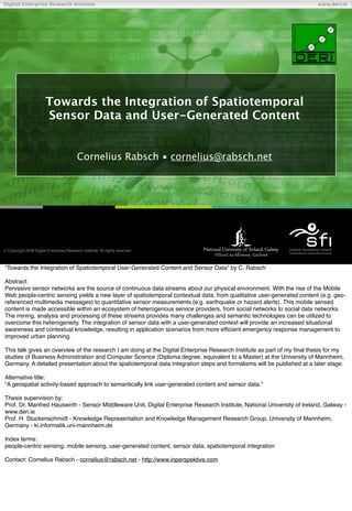
  • 1. Digital Enterprise Research Institute www.deri.ie Towards the Integration of Spatiotemporal Sensor Data and User-Generated Content Cornelius Rabsch • cornelius@rabsch.net Chapter  Copyright 2008 Digital Enterprise Research Institute. All rights reserved. “Towards the Integration of Spatiotemporal User-Generated Content and Sensor Data” by C. Rabsch Abstract: Pervasive sensor networks are the source of continuous data streams about our physical environment. With the rise of the Mobile Web people-centric sensing yields a new layer of spatiotemporal contextual data, from qualitative user-generated content (e.g. geo- referenced multimedia messages) to quantitative sensor measurements (e.g. earthquake or hazard alerts). This mobile sensed content is made accessible within an ecosystem of heterogenous service providers, from social networks to social data networks. The mining, analysis and processing of these streams provides many challenges and semantic technologies can be utilized to overcome this heterogeneity. The integration of sensor data with a user-generated context will provide an increased situational awareness and contextual knowledge, resulting in application scenarios from more efficient emergency response management to improved urban planning. This talk gives an overview of the research I am doing at the Digital Enterprise Research Institute as part of my final thesis for my studies of Business Administration and Computer Science (Diploma degree, equivalent to a Master) at the University of Mannheim, Germany. A detailed presentation about the spatiotemporal data integration steps and formalisms will be published at a later stage. Alternative title: “A geospatial activity-based approach to semantically link user-generated content and sensor data.” Thesis supervision by: Prof. Dr. Manfred Hauswirth - Sensor Middleware Unit, Digital Enterprise Research Institute, National University of Ireland, Galway - www.deri.ie Prof. H. Stuckenschmidt - Knowledge Representation and Knowledge Management Research Group, University of Mannheim, Germany - ki.informatik.uni-mannheim.de Index terms: people-centric sensing, mobile sensing, user-generated content, sensor data, spatiotemporal integration Contact: Cornelius Rabsch - cornelius@rabsch.net - http://www.inperspektive.com
  • 2. Ubiquitous Mobile Sensing Digital Enterprise Research Institute www.deri.ie Source: National Research Council USA Source: Nokia Research Center, 2008 [1] The global trends of pervasive sensor networks and sensors embedded into everyday devices goes along with a steadily increasing number of deployed mobile devices, already reaching over 4 billion in 2009 [1]. Sensors and mobile phones are highly connected by the fact that every modern phone embeds a variety of sensors: location, acoustical, light or orientation, for example. According to Nokia Research Center [1] there will be a shift from traditional sensor networks to a participatory sensing infrastructure that leverages available devices and puts humans in the loop. Thus leading to a sensing network utilizing people and their mobility. Mobile sensing is the origin for large heterogeneous spatiotemporal data sets that have to be mined, processed and analyzed which provides challenging tasks and complex problems. [1] Nokia Research Center, Sensing the World with Mobile Devices, http://research.nokia.com/files/insight/NTI_Sensing_- _Dec_2008.pdf, 2008
  • 3. Sensors + Mobile Phones + People Digital Enterprise Research Institute www.deri.ie To give an overview of the main concepts we take a closer look at sensors connected to mobile phones, people carrying mobile phones and mobile phones as place of origin for user-generated content and sensor data. Looking solely at networked sensors, we have a well understood infrastructure where sensors are part of sensor networks and sensor bases or social data networks can provide a persistence layer with varying degrees of data accessibility. Providers for this kind of service are Sensorbase [2], Sensorpedia [3] or Pachube [4], for example. Sensor middleware can be utilized to collect, process and analyze large amounts of sensor data. On the other hand, people in a networked world are part of online communities and create content within social networks. All user- generated content in Social Media is distributed over a variety of heterogeneous services. Photo community Flickr [5], video community YouTube [6] or generic social network Facebook [7], for example. These services act as valuable centralized places to collect and analyze social media contributions. Bridging the quantitative sensor world with the human-centric social media world is a challenging task. Mobile phones can play an important role as the place of origin for user-generated content and sensor data. The concept of mobile sensing is focusing on the mobile devices and its embedded sensors. Humans are seen as carriers providing the mobility which results in an opportunistic sensing infrastructure [1]. In both scenarios, sensors embedded into mobile phones and people submitting content with mobile phones, the networking aspect is essential and Internet connectivity is enabler to exchange and aggregate data. The Internet and the World Wide Web in specific provide a scalable infrastructure with shared well-accepted standards and technologies and thus build a ready-to-use foundation and platform for data distribution, mining and analysis. The specifics of data sharing around the aspects of provenance, trust, permissions and access rights wonʼt be in the focus of this research. [1] Lane et al., Urban sensing systems: opportunistic or participatory?, 9th workshop on Mobile computing systems, 2008, www.cl.cam.ac.uk/~mm753/papers/hotmobile08.pdf [2] Sensorbase.org [3] Sensorpedia.org [4] Pachube.com [5] Flickr.com [6] Youtube.com [7] Facebook.com [8] Campbell et al., The Rise of People-Centric Sensing. Internet Computing, IEEE (2008) vol. 12 (4) pp. 12 - 21
  • 4. Mobile + Sensors Digital Enterprise Research Institute www.deri.ie BioMapping.net by C. Nold NoiseTube, SONY Computer Science Laboratory CitySense, SenseNetworks Real Time Rome, MIT SENSEable City Lab We follow by giving a short overview about typical mobile sensing scenarios to clarify how mobile devices can be used to sense your physical environment. The NoiseTube project “turns your mobile phone into an environmental sensor and participates to the monitoring of noise pollution” [1]. Users can also annotate the sensed data with tags as ʻConstruction buildingʼ to give more background with the sensed location. CitySense [2] is built on top of Sense Networksʼ Macrosense location analytics platform [3] to report about nightlife activity in San Francisco by analyzing location traces and consumer behavior. BioMapping [4] measures the Galvanic Skin Response (GSR) to recognize emotional arousal at specific places as bridges or hard- to-cross streets. The Real Time Rome project [5] by the MIT SENSEable City Lab [6] analyzes cell phone data within the city of Rome to figure out consumer behavior and finding patterns in urban data collections [7]. Goal of these sensing application can be the utilization and analysis of the sensed data to influence human behavior, e.g. where to go next, which places have to be avoided, how to select the fasted path to a specific place, for example. [1] NoiseTube by SONY Computer Science Laboratory, http://noisetube.net/ [2] CitySense, Sense Networks, http://www.citysense.com, “Life San Francisco Nightlife Activity” [3] MacroSense, Sense Networks, http://www.sensenetworks.com/macrosense.php [4] BioMapping, C. Nold, http://biomapping.net [5] Real Time Rome, MIT SENSEable City Lab, http://senseable.mit.edu/realtimerome/ [6] MIT SENSEable City Lab, http://senseable.mit.edu/ [7] Reades et al., Cellular Census: Explorations in Urban Data Collection, Pervasive Computing, IEEE (2007) Vol. 6 (3) pp. 30 - 38
  • 5. Mobile + People Digital Enterprise Research Institute www.deri.ie Source: twitter.com/arunshanbhag “There’s a plane in the Hudson. i’m on the ferry going to pick up people. Crazy.” Source: www.flickr.com/photos/vinu Source: twitpic.com/135xa User-generated content, also referred as social media contributions, can be personal, entertaining, of uncertain quality, timely, contextual and often unpredictable. For the sake of simplicity and convincingness we give an overview of typical contributions of high importance and high quality. Citizen journalism refers to the act of citizens reporting about their neighborhood and the community they are living in, ranging from hyper-local news to on-the-spot emergency reports. The tools that facilitate citizen journalism are manifold and often free and easy to use. User ʻarunshanbhagʼ reports about a terrorist attack at the Taj Hotel in Mumbai [1] by using the micro-blogging service Twitter, user ʻvinuʼ on Flickr uploads and geo-references a photo about the same event with only a minor delay [2], user ʻjkrumsʼ is witnessing a plane crash and immediately takes a picture which got tens of thousands of views on Twitpic [3], to name a few real-life citizen journalism examples. Mobile mapping of earthquake catastrophes [4] is another example where it is important to know at which places a house is burning or where it collapsed and how big the impact was. It is important to note that location often matters and user-generated content is in many cases already geo-referenced by utilizing built-in GPS sensors in mobile phones or by manually selecting the correct location on a web mapping interface. [1] “Mumbai Blasts”, Twitter user arunshanbhag, http://twitter.com/arunshanbhag, accessed April 2009 [2] “Mumbai Attacks on Nov 26th 2008”, Flickr user vinu, http://www.flickr.com/photos/vinu/sets/72157610144709049/, accessed April 2009 [3] “US Airways Hudson River Plane Crash”, Twitpic user jkums, http://twitpic.com/135xa, accessed April 2009 [4] “Earthquake LʼAquilla”, Google Maps user TMG, http://maps.google.com/maps/ms? msa=0&msid=112463924814795169379.000466dc7c10ff9a99bd4&ie=UTF8&ll=42.3496,13.397613&spn=0.013638,0.032187&t=p& z=15, accessed April 2009
  • 6. Related Work Digital Enterprise Research Institute www.deri.ie References: see slide notes To distinguish the related work we use a) a breakdown by type of content and b) a breakdown by the heterogeneity. The types of data can be user-generated content, sensor data or scenarios where both are considered for integration and analysis. With regards to the heterogeneity, the distinction is between a closed world scenario where one or multiple well-known data sources are applied and an open world scenario where multiple heterogeneous data sources are applied. The latter provides a much higher complexity because of the missing semantic interoperability between service providers and their data schemas. The focus lies on the data integration and analysis of spatiotemporal user-generated content and sensor data in a mobile context. Note: Will be clarified and regrouped later on. [1] Eagle and Pentland, Reality mining: sensing complex social systems. Personal and Ubiquitous Computing, 2006 [2] Sheth et al., Semantic Sensor Web, IEEE Internet Computing, 2008 [3] Calabrese et al., Wikicity: Real-time Location-sensitive Tools For The City, IEEE Pervasive Computing, 2007 [4] Girardin et al., Digital Footprinting: Uncovering Tourists with User-Generated Content, IEEE Pervasive Computing, vol. 7 (4) pp. 36 - 43, 2008 [5] Urban Sensing, CENS/UCLA, Center for Embedded Networked Sensing, http://urban.cens.ucla.edu/ [6] PEIR, the Personal Environmental Impact Report, http://urban.cens.ucla.edu/projects/peir/ [7] Real Time Rome, MIT SENSEable City Lab, http://senseable.mit.edu/realtimerome/ [8] Sensorbase.org [9] Sensorpedia.org [10] Pachube.com [11] SIOC, Semantically-Interlinked Online Communities, http://sioc-project.org/ [12] BioMapping, C. Nold, http://biomapping.net [13] NoiseTube by SONY Computer Science Laboratory, http://noisetube.net/
  • 7. Research Questions Digital Enterprise Research Institute www.deri.ie How can spatiotemporal user-generated content be  semantically linked to sensor data? What kind of semantics are required to describe,  analyze and query heterogenous geospatial activities? How can we increase and assess the contextual  information provided by sensor data and user- generated content?  Why? Increased eficiency in emergency response management, urban planning or targeted advertising,... The focus will be on data access and data integration in a scenario where the dataʼs life-cycle is important to understand, i. e. mobile-originated web-accessible content provided by heterogenous services.
  • 8. Geospatial Activity Semantics Digital Enterprise Research Institute www.deri.ie * *M. Perry. A framework to support spatial, temporal and thematic analytics over semantic web data, 2008 The underlying concepts of the geospatial activity vocabulary are the shared semantics of time, space and theme [1] of the user- generated content and the sensor data. GeoAct is a vocabulary utilizing Semantic Web technologies as RDF for the representation of spatiotemporal thematic data. RDF provides the basis for easy to use extension and integration mechanisms. The red circles show common vocabularies as FOAF, Dublin Core or SIOC that can be interlinked to the GeoAct Activity base class. A gazetteer schema as the one of Geonames [2] can be utilized to refer GPS coordinates to well-known geographical identifiers as a way to geographically cluster activity data. This section and the following about the GeoAct schema and the underlying concepts will be reviewed in detail in a different presentation. [1] Sheth and Perry, Traveling the Semantic Web through Space, Time, and Theme, IEEE Internet Computing, 2008 [2] http://www.geonames.org/
  • 9. Activity Example as RDF/XML Digital Enterprise Research Institute www.deri.ie Semantic Gap! RDF / Atom Triples? Atom / RSS Feed Content: Earthquakes, Hazards, Weather, Traffic, Photos, Multimedia, Messages, Events,... A sample RDF/XML extract of a geoact:Activity class about an earthquake notification as provided by the U.S. Geological Survey. The semantic gap shows that more specific semantics of the earthquake notification and the seismic waves sensors are hidden in non-structured text. A solution are more domain-specific ontologies extending the GeoAct vocabulary. Web feeds (Atom or RSS with GeoRSS extensions) are already providing a variety of activity information from earthquakes to hazards to multimedia messages or event information. Sample feed sources for New York City, USA: USGS M2.5+ Earthquakes http://earthquake.usgs.gov/eqcenter/catalogs/1day-M2.5.xml Brightkite Place Stream http://brightkite.com/places/ede07eeea22411dda0ef53e233ec57ca/objects.rss?limit=100filters=notes,photos Flickr Photo Stream http://www.flickr.com/services/feeds/geo/?tags=newyork or http://www.flickr.com/services/feeds/geo/?tags=manhattan Upcoming Event Stream http://upcoming.yahoo.com/syndicate/v2/place/hVUWVhqbBZlZSrZU Yahoo! Traffic Alert Stream http://local.yahooapis.com/MapsService/rss/trafficData.xml?appid=YdnDemolocation=new%20york%20city Weather, NYC, Central Park http://www.weather.gov/xml/current_obs/KNYC.rss
  • 10. GeoAct Data Flow Digital Enterprise Research Institute www.deri.ie The GeoAct prototype utilizes the GeoAct vocabulary for the integration of sensor data and user-generated content. Social networks for user-generated content and social data networks for sensor data are the ʻsinksʼ of the platform that provide web- accessibility by supporting web feeds as Atom or other open standard. These services should act as the neutral storage and aggregation services in an ecosystem where sensor data and unser-generated content is shared in equal ways. Note: More to follow. First the focus is on available web content by ignoring the assumption that the data should be mobile- originated.
  • 11. GeoAct TimeMap Visualization Digital Enterprise Research Institute www.deri.ie The screenshot shows one dynamic view of the TimeMap [1] interface where spatiotemporal activity content of a variety of sources around New York City was aggregated from web feeds and visualized. The data mining is decoupled from the querying and visualization part. The GeoAct prototype takes a bounding box as the geospatial query parameter and a time period as temporal query parameter to visualize on a interactive TimeMap crawled web-accessible geospatial activity data. The goal is to visualize heterogeneous spatiotemporal data from a variety of service providers, e.g. Flickr, Brightkite, Twitter, Yahoo! Traffic or the U.S. Geological Survey. The implementation is built around the Ruby on Rails web framework [2] and the relational database PostgreSQL [3] with the PostGIS [4] extension for improved geospatial queries. A triple store with a SPARQL endpoint will be used for advanced querying. For simplicity, privacy considerations are not taken into account for this work and all crawled content is publicly available. For user- generated content it means that the user agreed to make his or her social media contribution accessible to everyone. [1] Timemap.js is a Javascript library to help use Google Maps with a SIMILE timeline, http://code.google.com/p/timemap/ [2] Ruby on Rails, http://rubyonrails.org/ [3] PostgreSQL, http://www.postgresql.org/ [4] PostGIS, http://postgis.refractions.net/
  • 12. First Conclusions Digital Enterprise Research Institute www.deri.ie Sensor data and UGC can fit together  integration analysis of both required to fully understand  the context and to increase situational awareness  raw sensor data streams not useful in the open world scenario - middleware, social data networks?  Mobile phone provides same origin for production of UGC SD Neighborhood level “real-time” data not (yet) realistic  Demand for (social) sensor sharing infrastructure  FireEagle, Pachube, SensorPedia, SensorBase, Web Feeds,  UGC Metadata (machine tags; EXIF) To increase situational awareness heterogeneous data sets with spatiotemporal sensor data and user-generated content can be used. Shared semantics for time, location and theme provide a central point for the data integration steps. There is a growing demand for a sensor data sharing infrastructure where sensors and sensor networks provide their collected data streams in accessible ways to third parties interested in integrating and remixing the data. These services not only take care about the data aggregation and accessibility, a management and provenance layer can also help to track the flow and origin of the data, for example. We refer to it as social data networks with respect to the analogy to social networks. Social networks or online communities are carriers of user-generated content and provide privacy layers and mechanisms to distribute publicly available content. In [1] the integration of social networks and sensor networks is considered and the question how sensors can extend social networks or replace humans to answer certain queries. The focus is on using existing connections and privacy concepts within a social network to share and access sensor devices. [1] Breslin et. al, Integrating Social Networks and Sensor Networks, W3C Workshop on the Future of Social Networking, 2009 http://www.w3.org/2008/09/msnws/papers/sensors.html
  • 13. Next Steps Digital Enterprise Research Institute www.deri.ie Sample SPARQL Queries Inference  “All activity topics in case of an earthquake on April 2nd 2009 by the service  www.flickr.com near Time Square” Advanced Web Mining  Named entity recognition to extract location data from  unstructured text (e. g. Twitter messages) via APIs Prototype refinements (querying, export,  documentation,...)  Thesis write-up (until June ‘09) Explaining multiple SPARQL [1] queries that require the availability of sensor data and user-generated content helps to understand how querying on the crawled web content can be done. Reasoning can be described by utilizing extended GeoAct activities. [1] SPARQL Query Language for RDF, http://www.w3.org/TR/rdf-sparql-query/