A Case Study of the Morphological Change of Four Wards of Dhaka City over the Last 60 years (1947-2007)
•
5 gefällt mir•1,837 views

This presentation is the thesis defense of our Bachelor of Urban and Regional Planning in Bangladesh University of Engineering and Technology (BUET).

Empfohlen
Weitere ähnliche Inhalte
Was ist angesagt?
Was ist angesagt? (20)
Andere mochten auch
Andere mochten auch (20)
Ähnlich wie A Case Study of the Morphological Change of Four Wards of Dhaka City over the Last 60 years (1947-2007)
Ähnlich wie A Case Study of the Morphological Change of Four Wards of Dhaka City over the Last 60 years (1947-2007) (20)
Mehr von Bayes Ahmed
Mehr von Bayes Ahmed (16)
Kürzlich hochgeladen
Kürzlich hochgeladen (20)
A Case Study of the Morphological Change of Four Wards of Dhaka City over the Last 60 years (1947-2007)
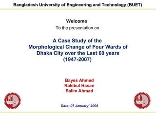
- 1. Welcome To the presentation on A Case Study of the Morphological Change of Four Wards of Dhaka City over the Last 60 years (1947-2007) Bayes Ahmed Rakibul Hasan Salim Ahmad Date: 07 January’ 2008 Bangladesh University of Engineering and Technology (BUET)
- 2. Urban Morphology is the study of the physical form of a city, which consists of Street patterns, Building sizes and Shapes, Architecture, Population density and Patterns of different land uses Urban morphology allows to understand the origin of forms, to explain past transformations and to better situate those to come Urban Morphology
- 3. As society radically changed after British colonial period , Dhaka City underwent drastic changes over the past decades In the process of urbanization the physical characteristics of Dhaka City is gradually changing as open spaces and water bodies are converted into built up areas It is necessary to track the morphological changes of Dhaka City over the last 60 years (1947-2007) which mainly includes the changes of physical form of the city Background of the Study
- 4. Objectives of the Study The study has been conducted to achieve the following objectives i) To study the transformation of urban form of Dhaka City over the last 60 years (1947-2007) ii) To analyze the modern urban fabric of Dhaka City The first part of this study is attempted to delineate the evolutionary phases of Dhaka as organic development as well as planned development The last part is the empirical and syntactic analysis of study areas
- 5. Methodology Preparation of Report Analysis and Interpretation Primary Data Collection Secondary Data Collection Collection of Data Selection of the Study Area Formulation of Objectives Selection of the Project
- 7. Axial Map records the least set of longest and straightest lines of sight and access which covers the public system of open spaces Integration of a line is a value which indicates the degree to which a line is more integrated, or segregated/inaccessible Integration Core of a settlement is 10-25 percent of the most integrated lines, numbered in order of integration Connectivity measures the number of immediate neighbours that are directly connected to a space Control measures the degree to which a space controls access to its immediate neighbours Intelligibility is the degree of correlation between global and local properties of each line in the system Components of Space Syntax
- 8. Ward 72
- 9. Ward 72 (Global Integration)
- 10. Ward 49
- 11. Ward 49 (Global Integration)
- 12. Ward 18 and 19
- 13. Ward 19 (Global Integration)
- 14. Biswa Road Baridhara Baridhara Biswa Road [1973] [1987] Madani Avenue Kalachadpur Shahzadpur Kalachadpur Ward 18
- 15. Ward 18 (Global Integration)
- 16. Findings